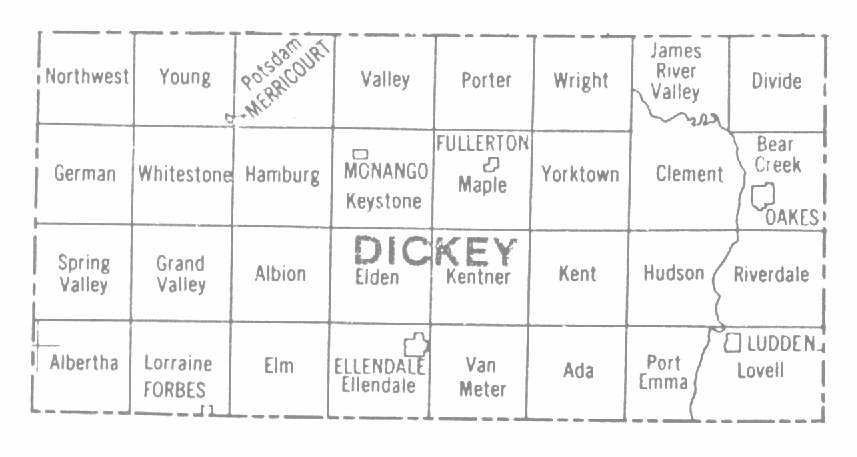
Dickey County North Dakota Township Map
The Land Ordinance of 1785, enacted by the Continental Congress on May 20, 1785 authorized the rectangular system of public land surveys conducted in the Public Domain States. The Land Act of 1796 later changed this Ordinance.
The law provides that public lands of the United States (which includes North Dakota and 29 other states) shall be divided by lines intersecting true north and south lines at right angles so as to form townships six miles square. The townships, in turn, are divided into 36 sections, each one mile square and containing approximately 640 acres in each section.
Just a note here: The 1884 Atlas Map of Dickey County showed most of the same townships divided into 16 units and only 12 had names.
Elements of the rectanglar survey include:
- Initial Point - This is the intersection of the principal meridian and the base line of the survey.
- Principal Meridian - This is a line running north and south through the initial point on a true parallel of longitude.
- Base Line - This is a line running east and west through the inital point on a true parallel of latitude.
- Standard Parallels (also called correction lines) - These are lines extending east and west from the principal meridian, usually at intervals of 24 miles north and south of the base line.
- Guide Meridians - These are lines extending north and south from the base line, usually at intervals of 24 miles east and west from the principal meridian.
An Example of a Public Land Survey
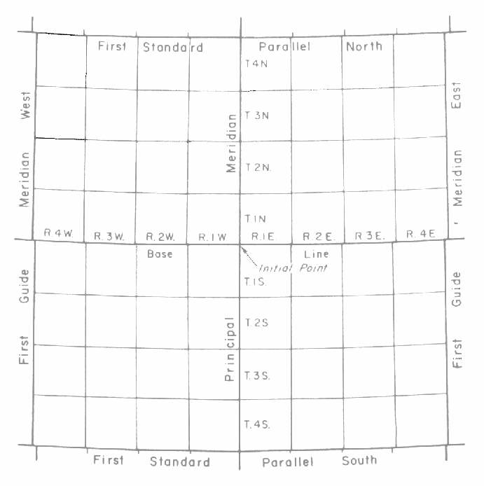
In this rectangular plan the township boundaries are intended to be due north and south or due east and west. The boundaries running north and south are termed "range lines." The boundaries running east and west are called "township lines."
The Initial Point governing ND land surveys is known as the Fifth Principal adopted in 1815. The Fifth Principal governs surveys (wholly or in part) in the states of Arkansas, Iowa, Minnesota, Missouri, North Dakota*, and South Dakota. The coordinates for the Fifth Principal are latitude 34° 38' 45" and longitude 91° 03' 07". (* wholly) Thank you to Lorraine A. Manz, Geologist
North Dakota Geological Survey Tel: (701) 328 8000
600 East Boulevard Fax: (701) 328 8010
Bismarck, ND 50505-0840 E-mail: lmanz@state.nd.us
If you have other questions regarding initial points for land surveys Lorraine recommends this web page, which is on the California BLM website.
© Copyright 2002-2017
Dickey Co., NDGenWeb Coordinator