|
What Is A Township? |
|
Township Maps Click on Township Name for Landowners. Landowner Names are not included in Search Utility. |
||||
|
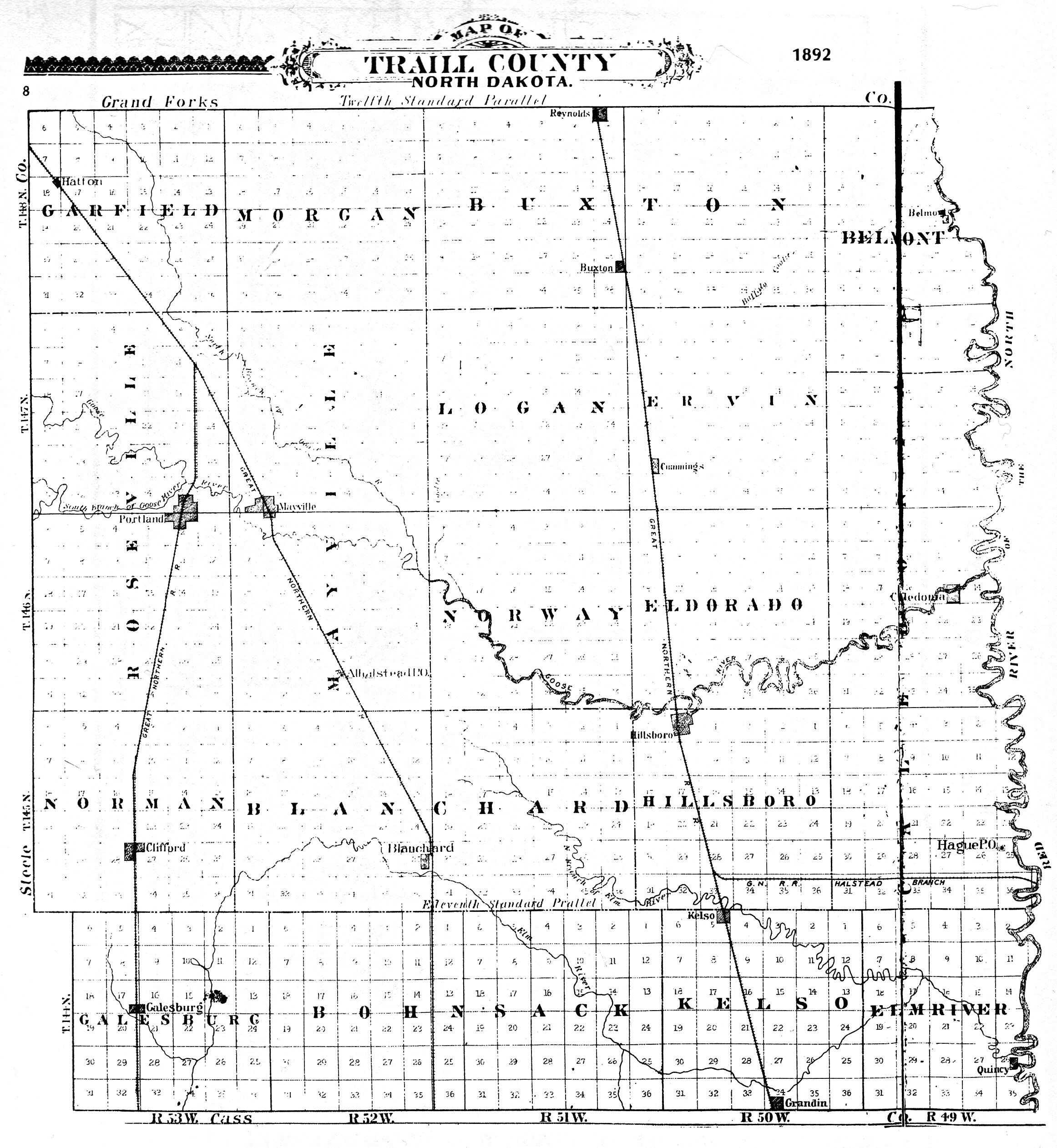
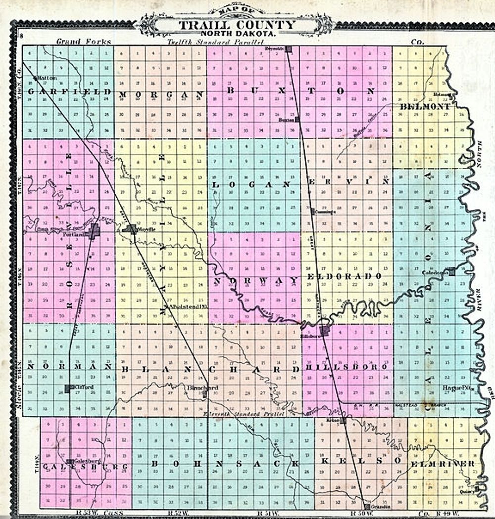
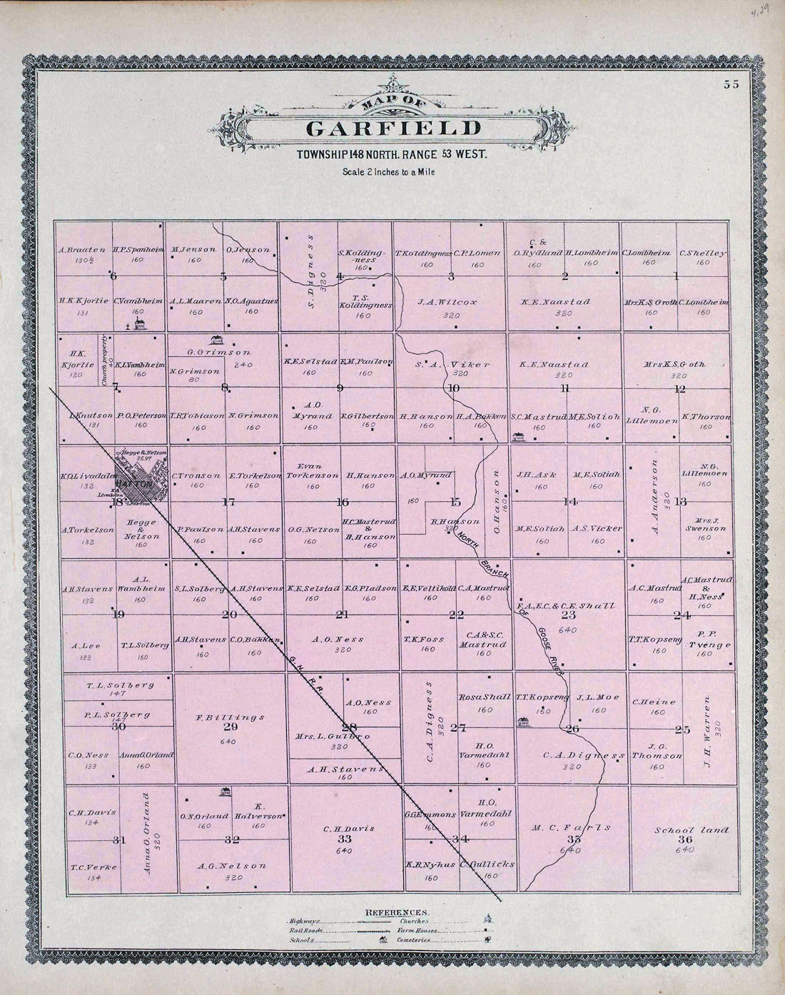
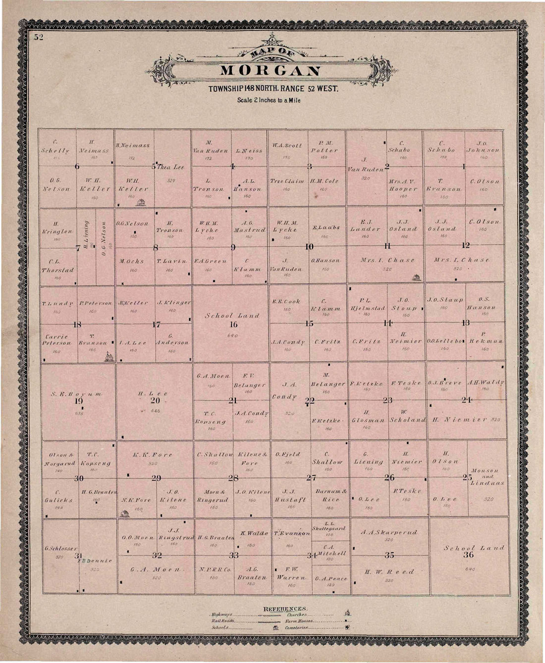
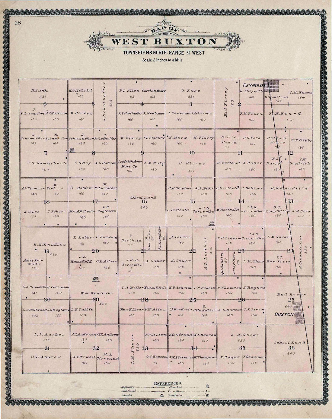
1892 1892 Color |
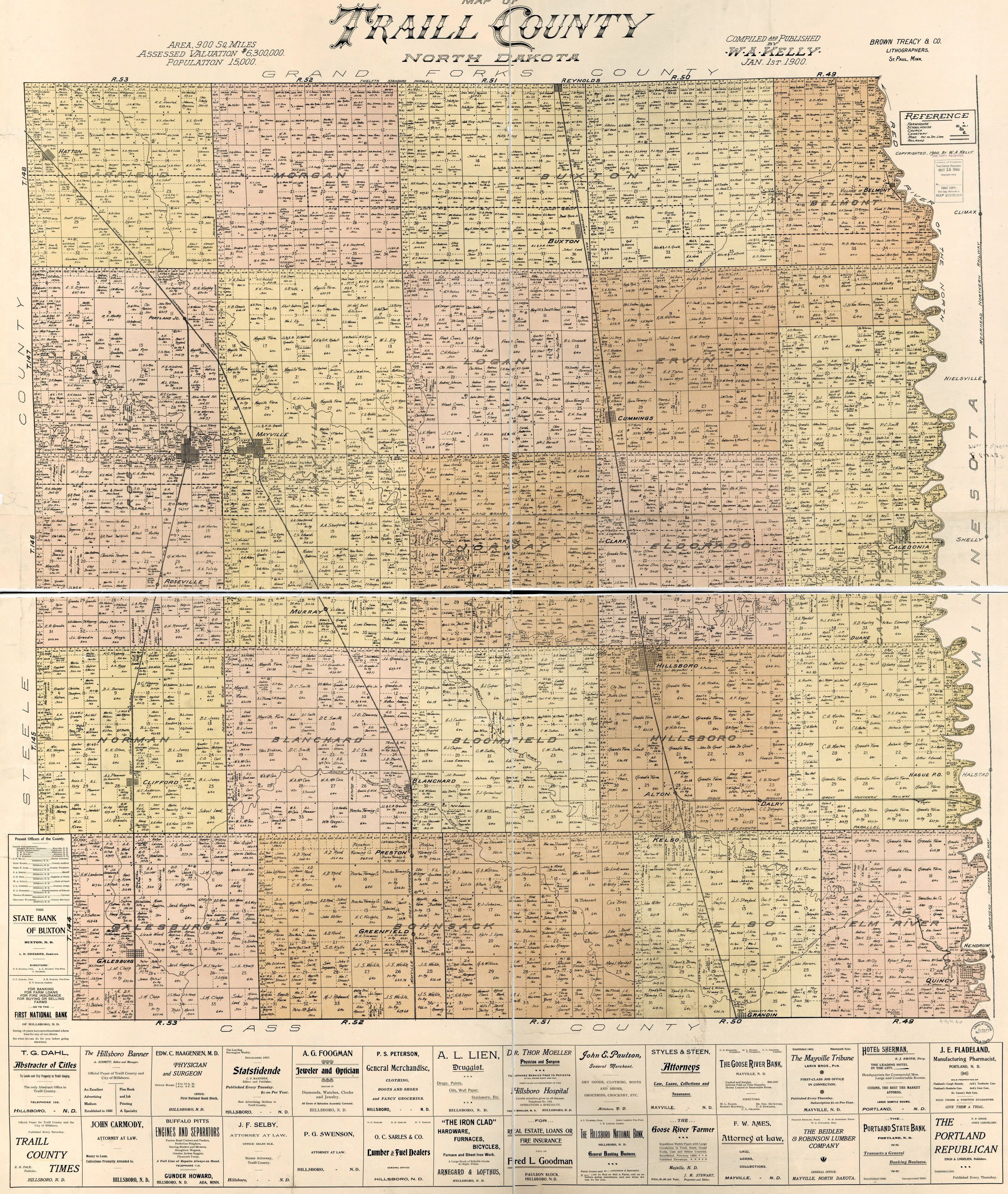
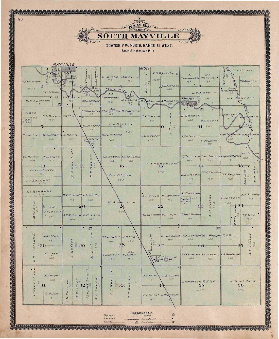
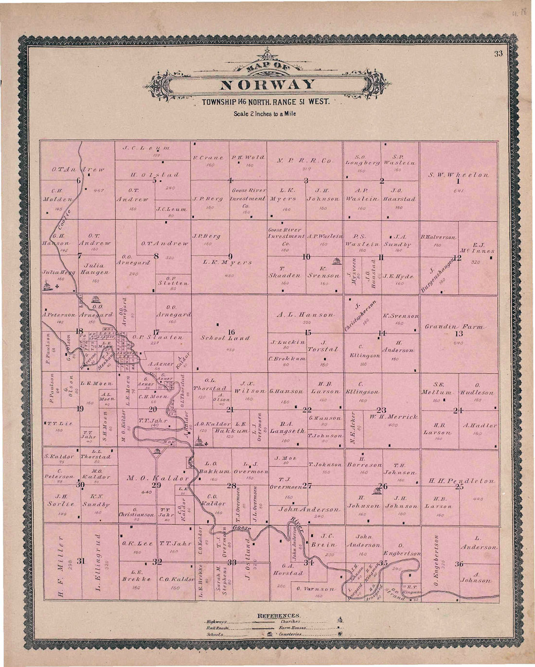
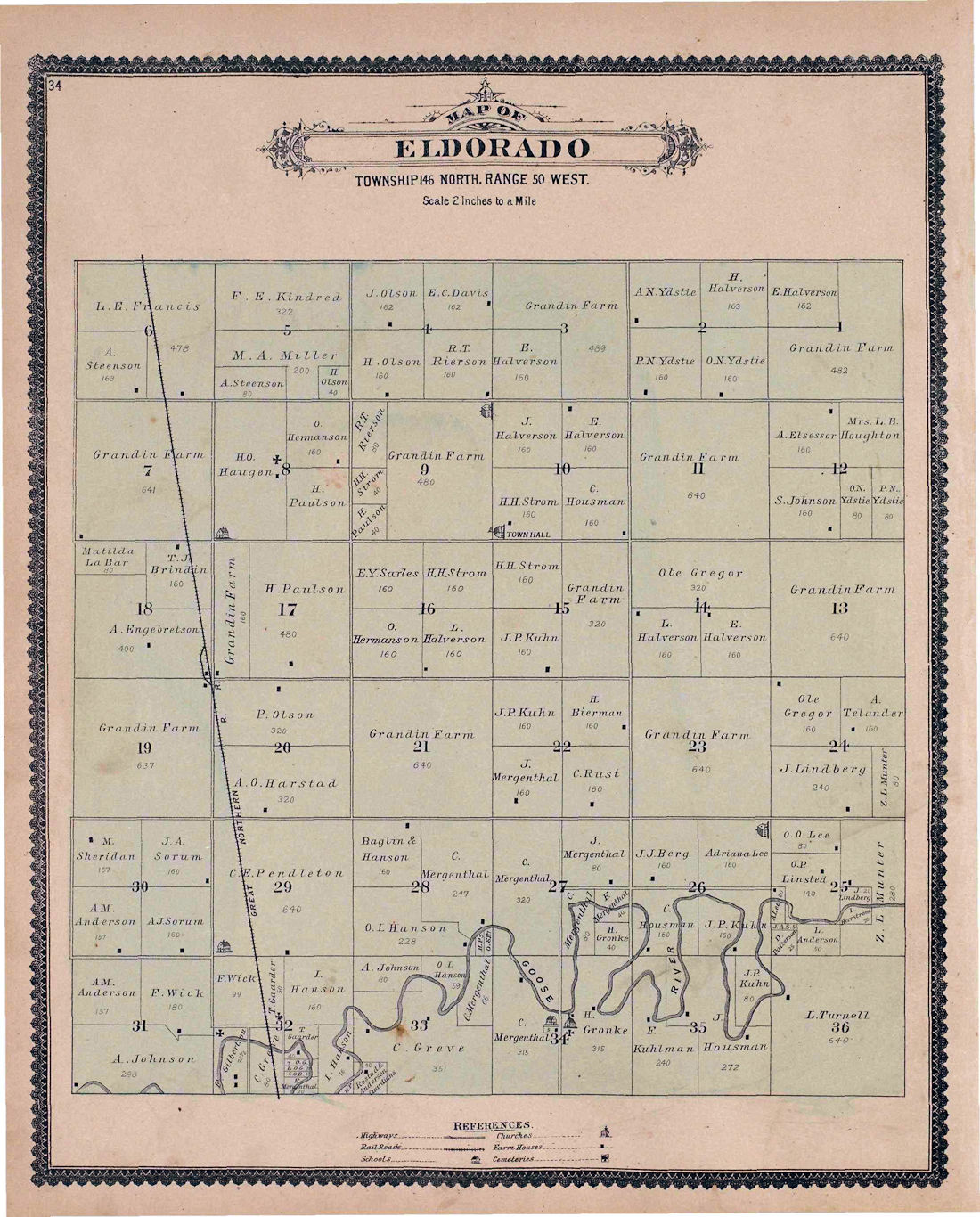
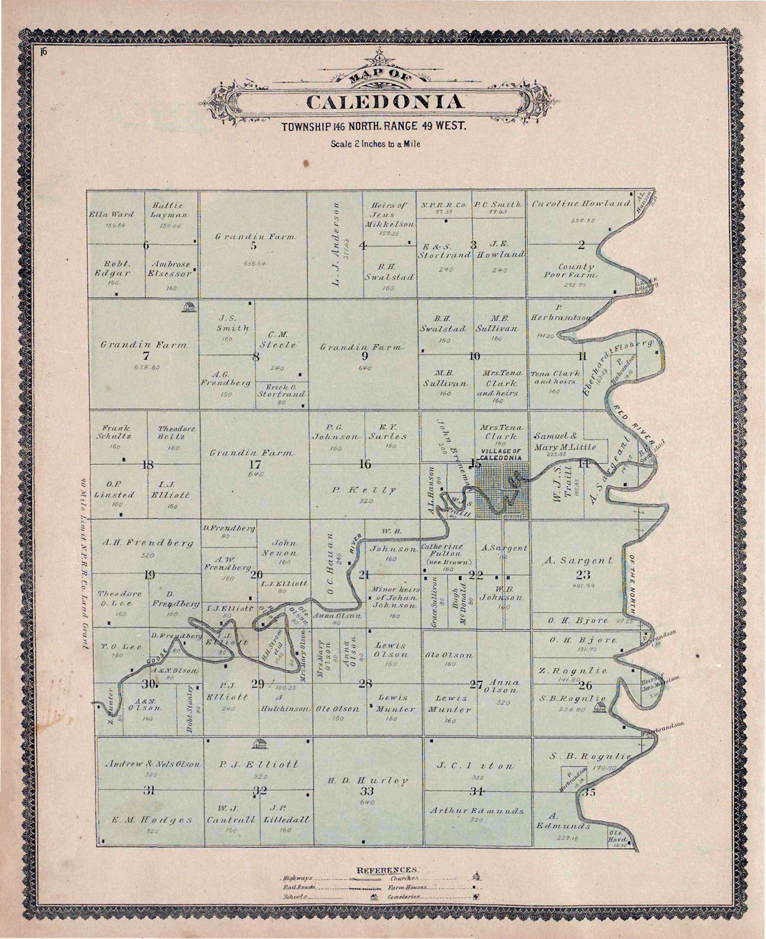
1900 (Has Landowners) |
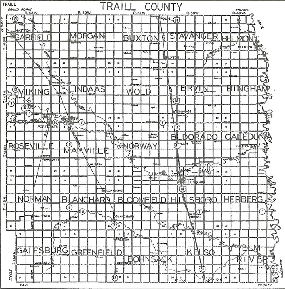
1933 - ^ |
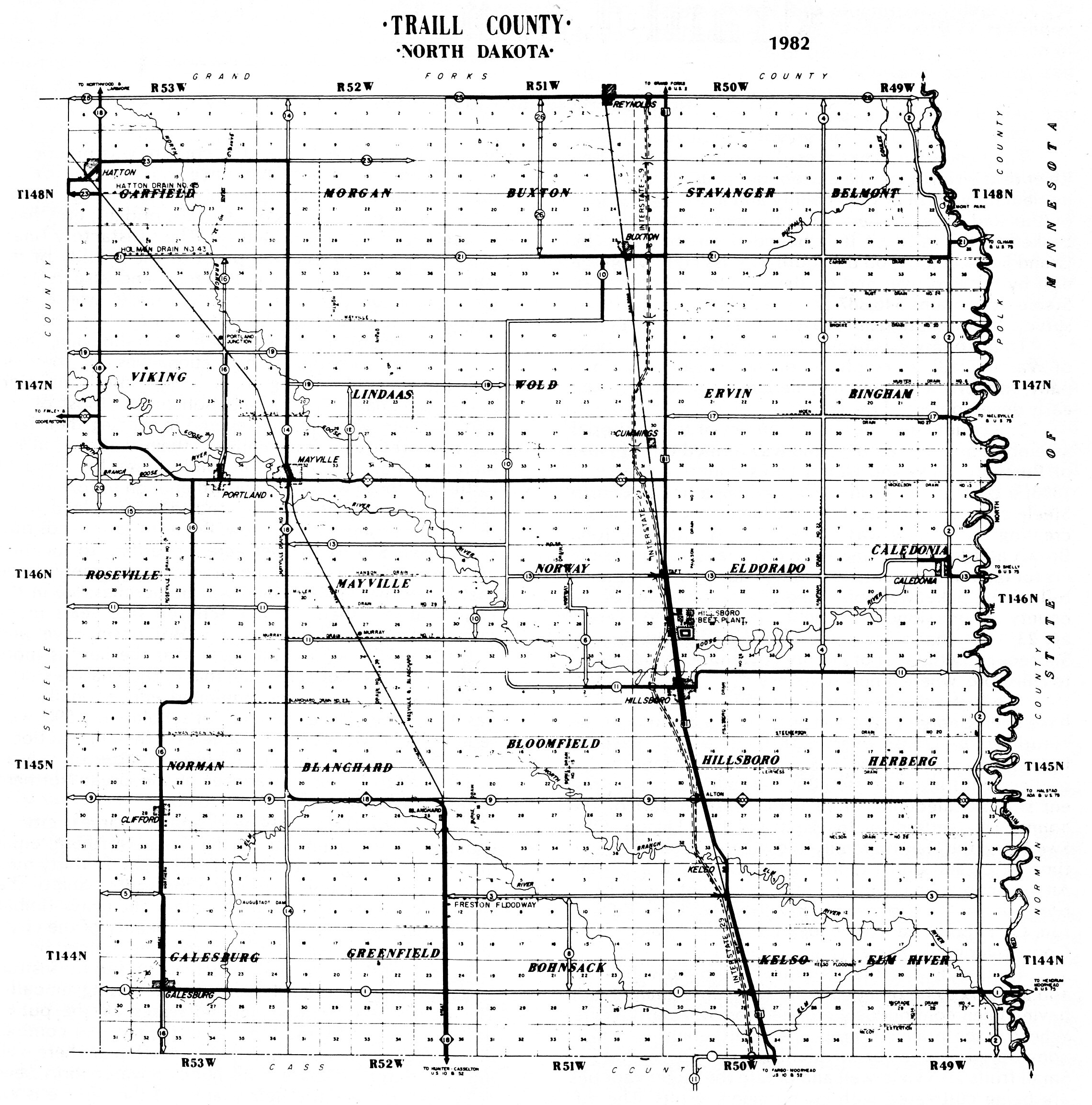
1982 |
2010 - Census* |
|
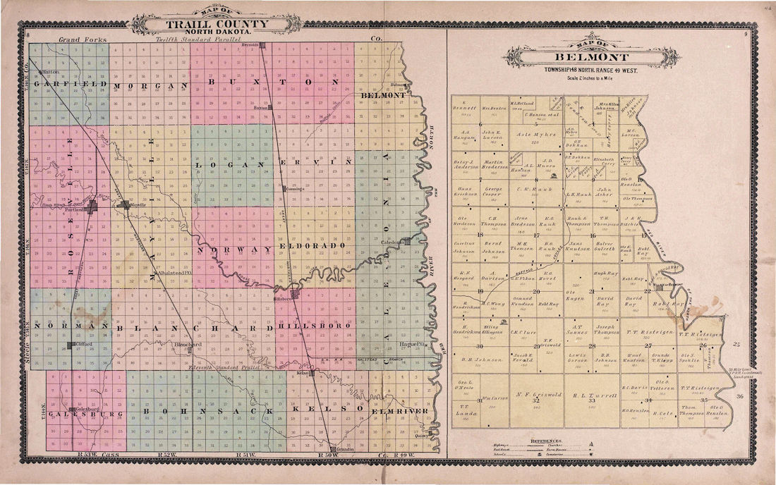
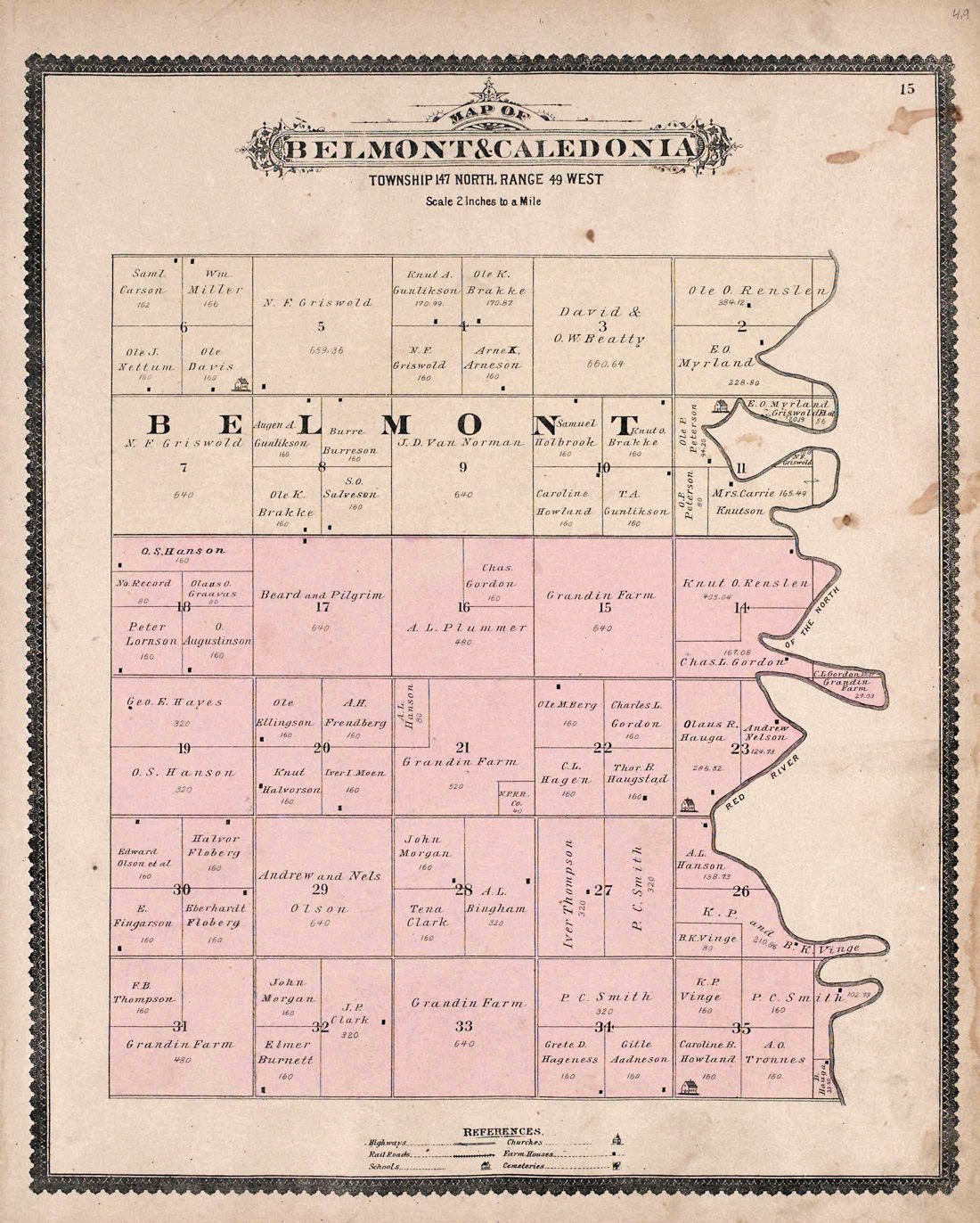
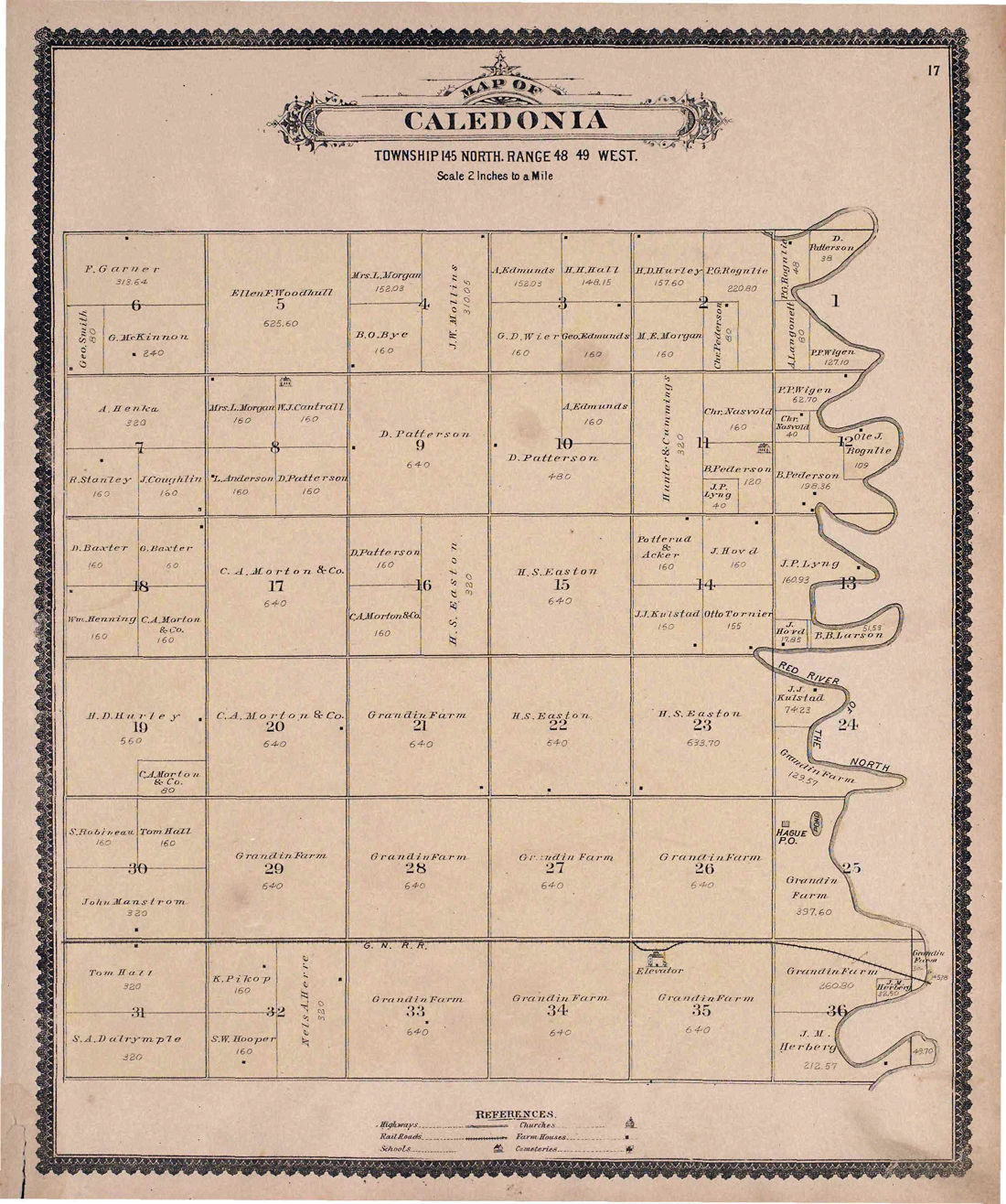
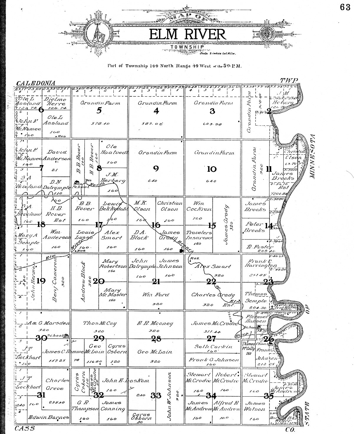
^ = Contributed by Jon Raymond. Atlas of North Dakota, W.W. Hixson and Company * = A Census Block Map - Does not show all Townships The 1964 history of the Red River Valley contains a great deal of information and names associated with the townships in the valley. They include Bingham, Eldorado, Elm River, Ervin, Caledonia, Herberg, Norway, and Stavanger. |
||||
|
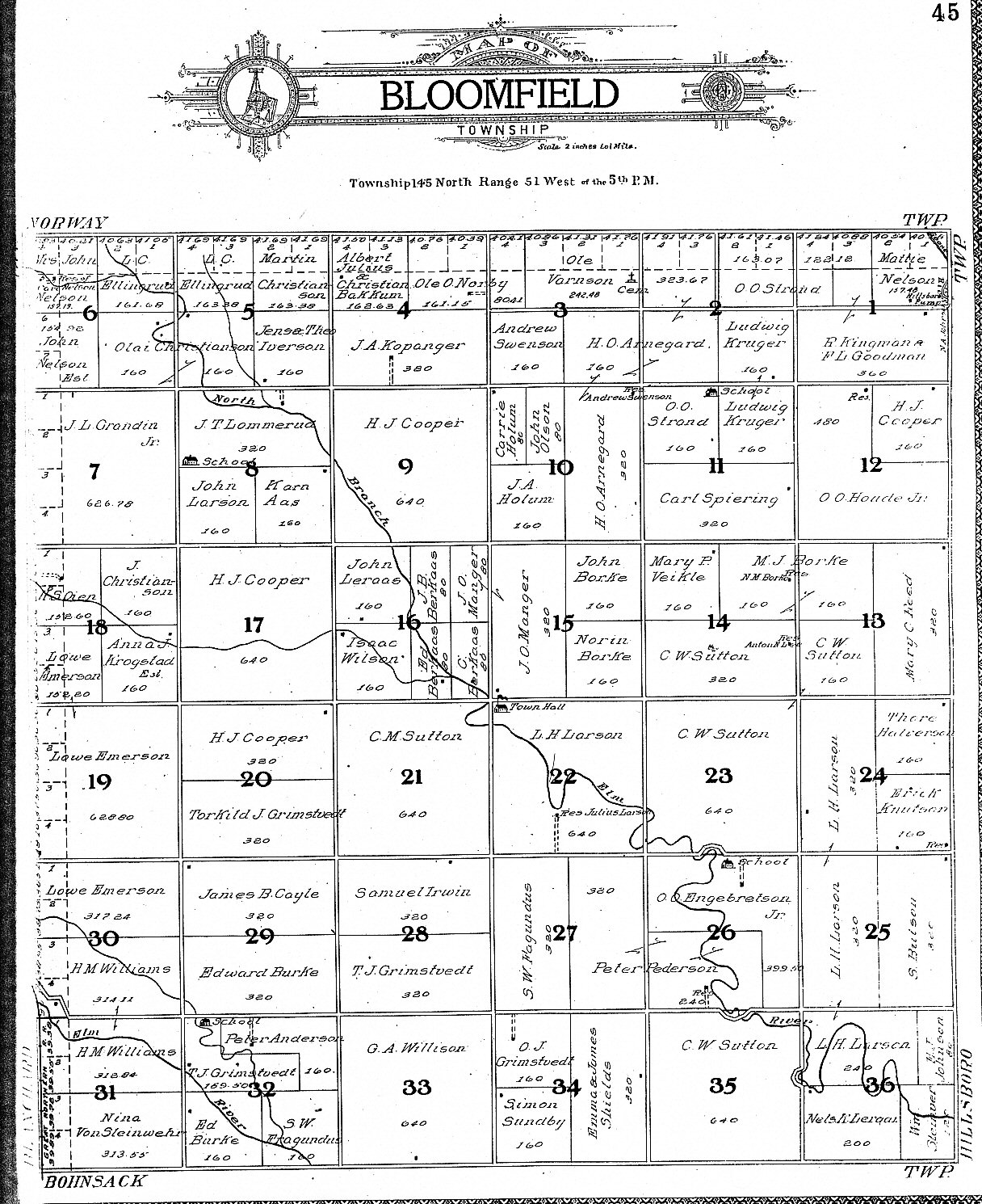
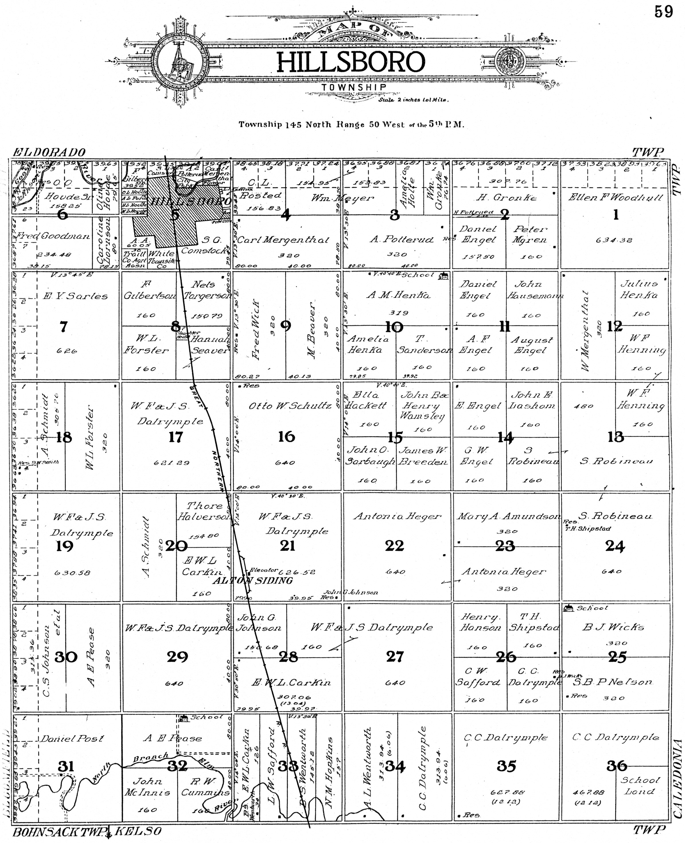
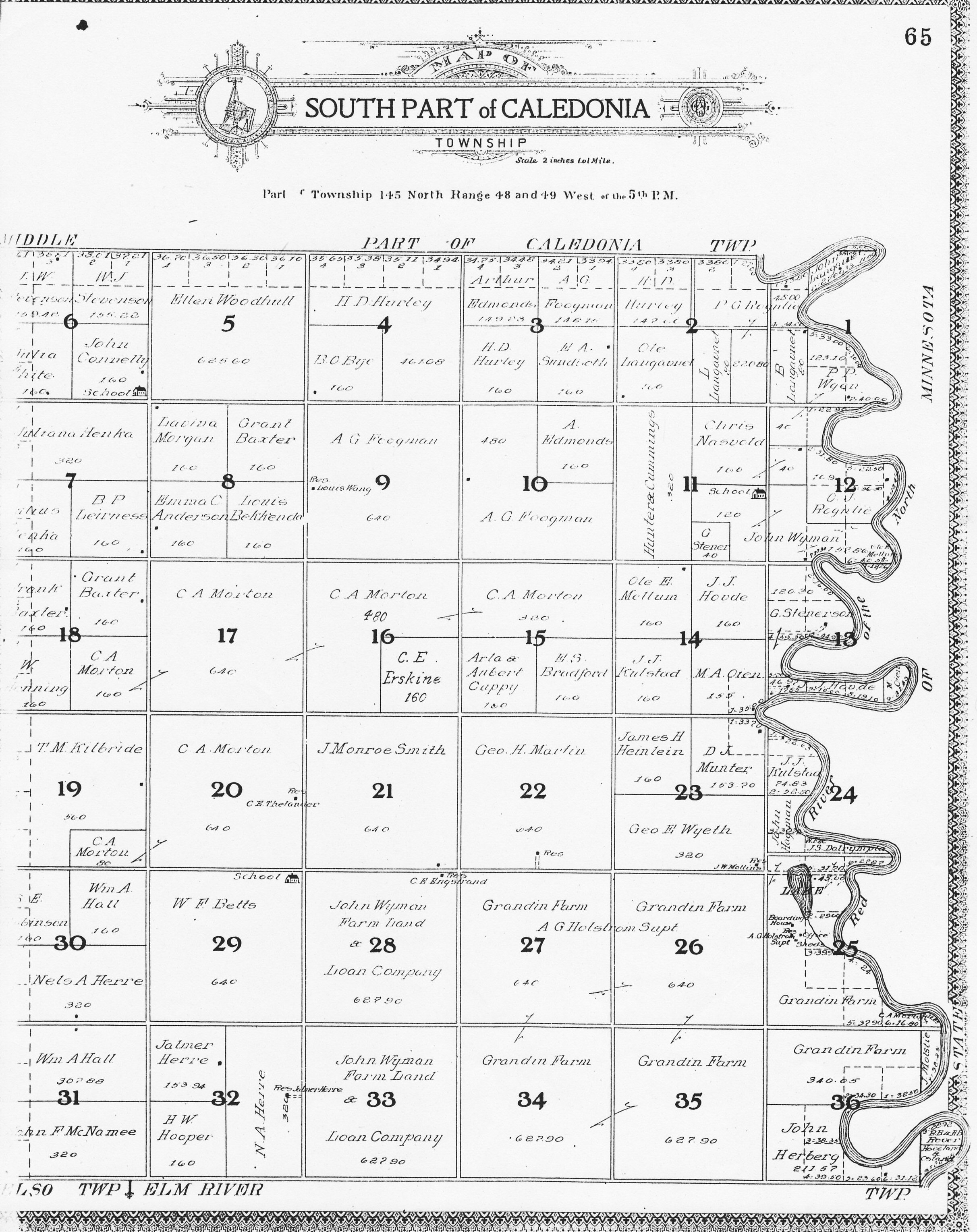
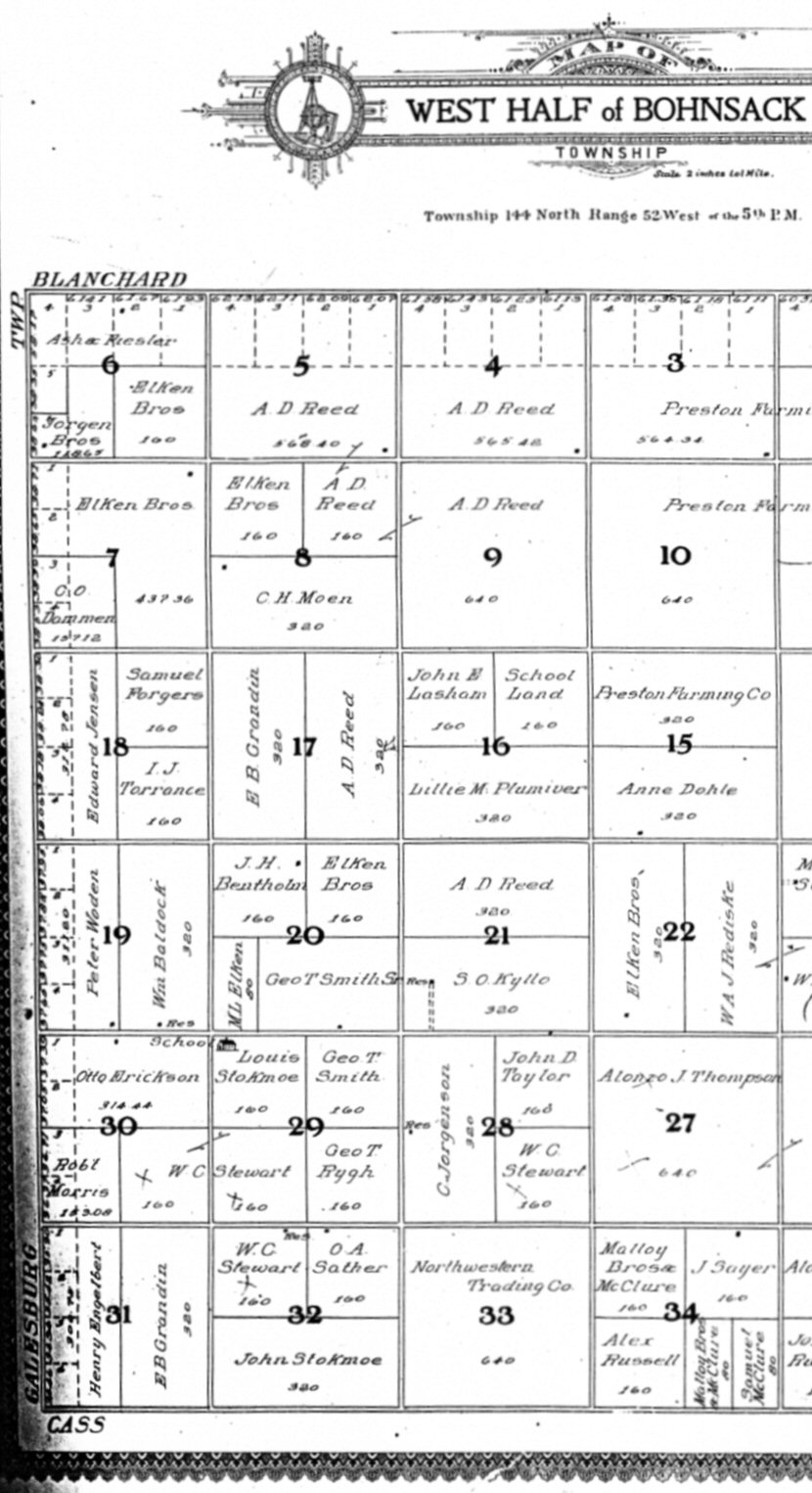
Landowner Plat Maps Click on Township Name for Landowners. Landowner Names are not included in Search Utility. |
||||
|
1892 |
||||
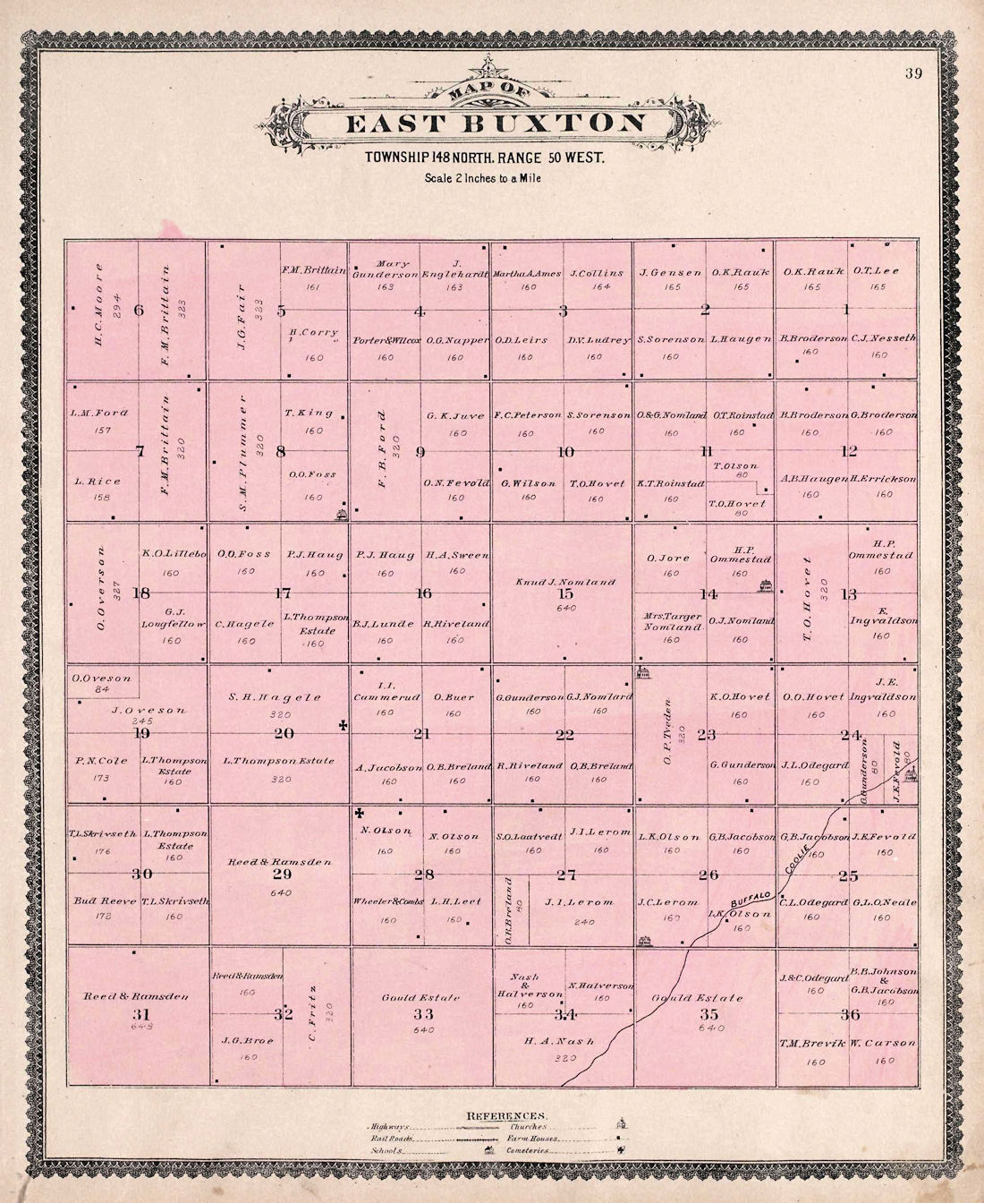
| Garfield | Morgan | West Buxton | East Buxton | North Belmont/County |
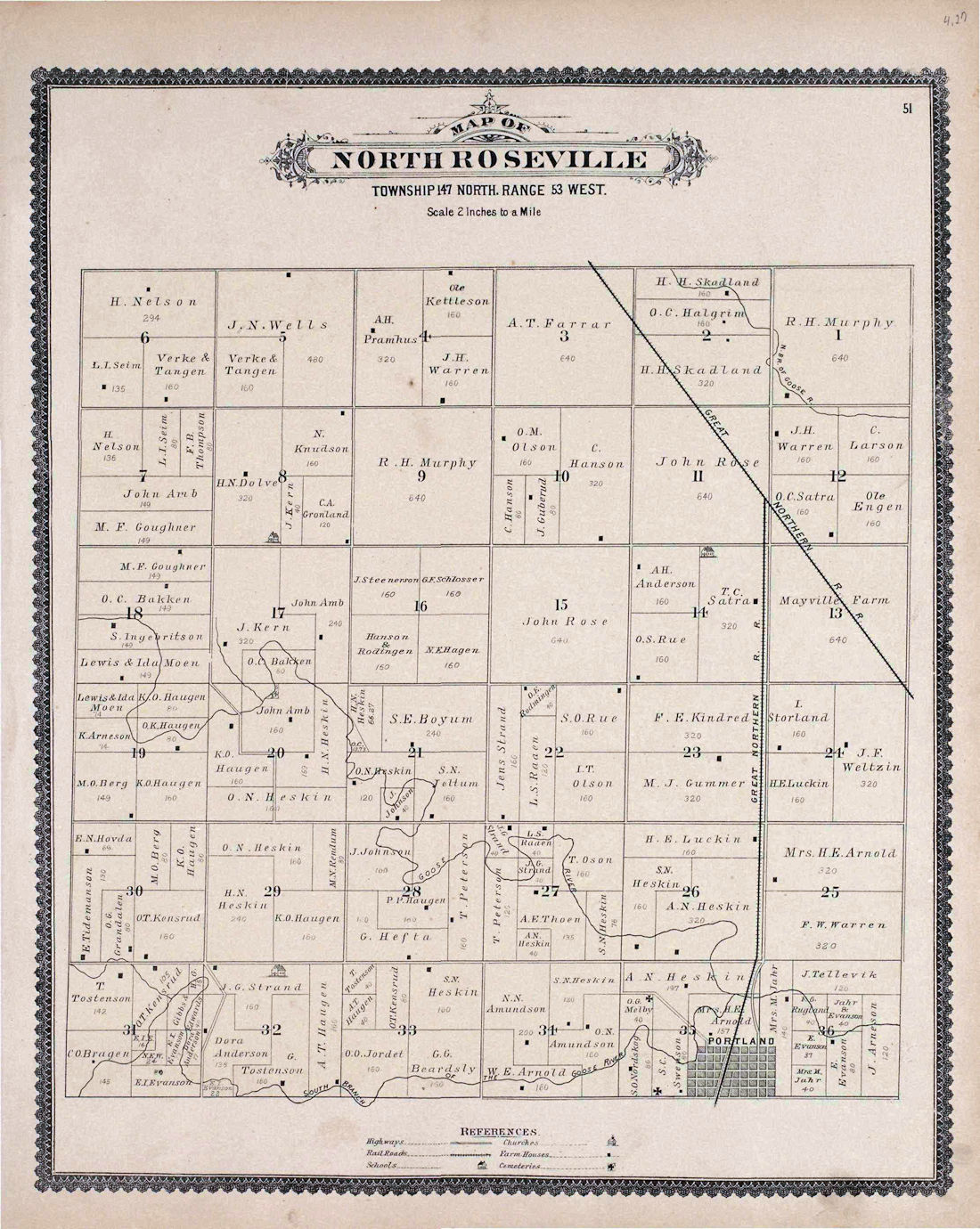
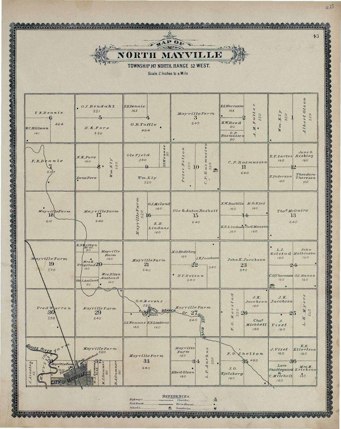
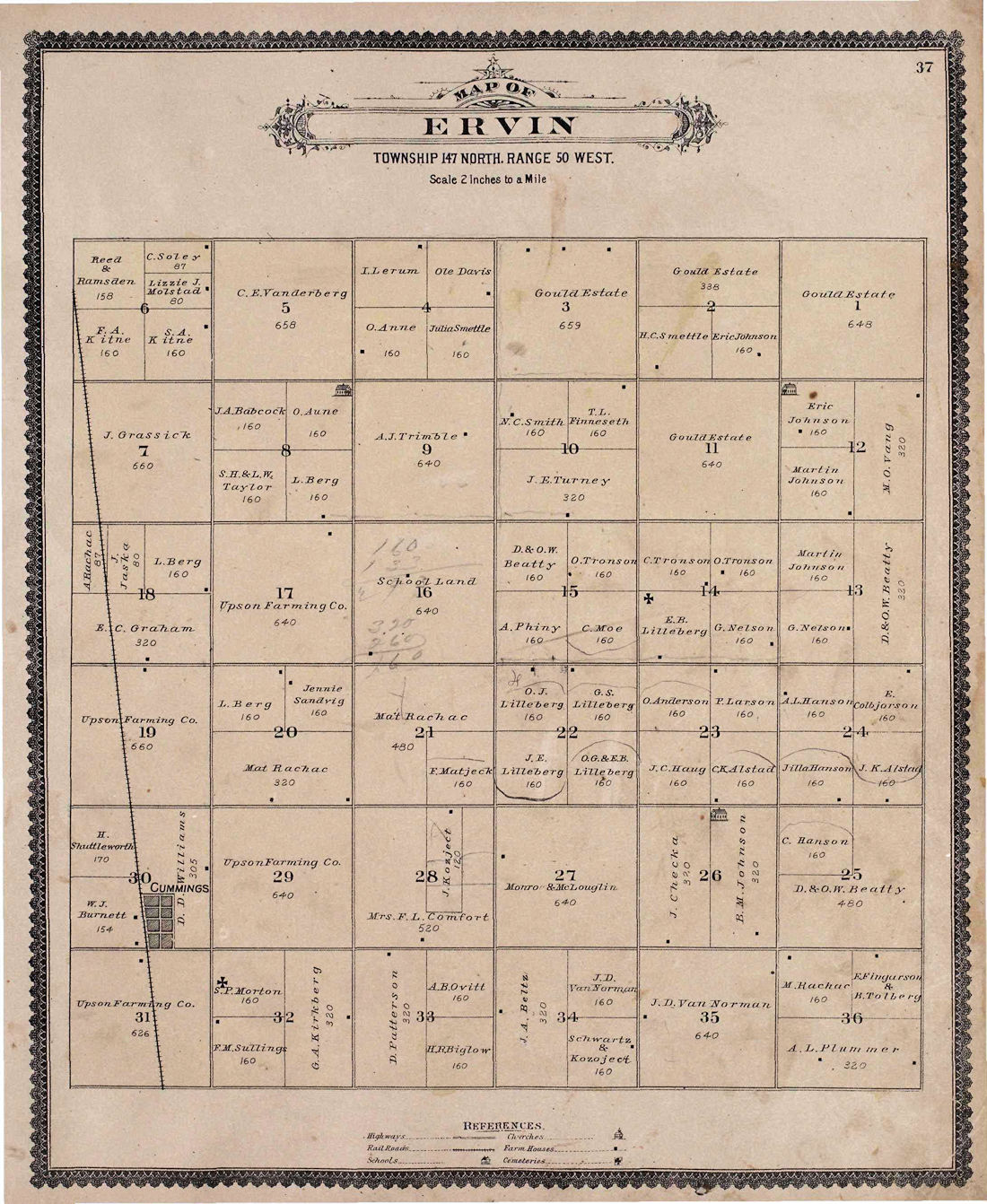
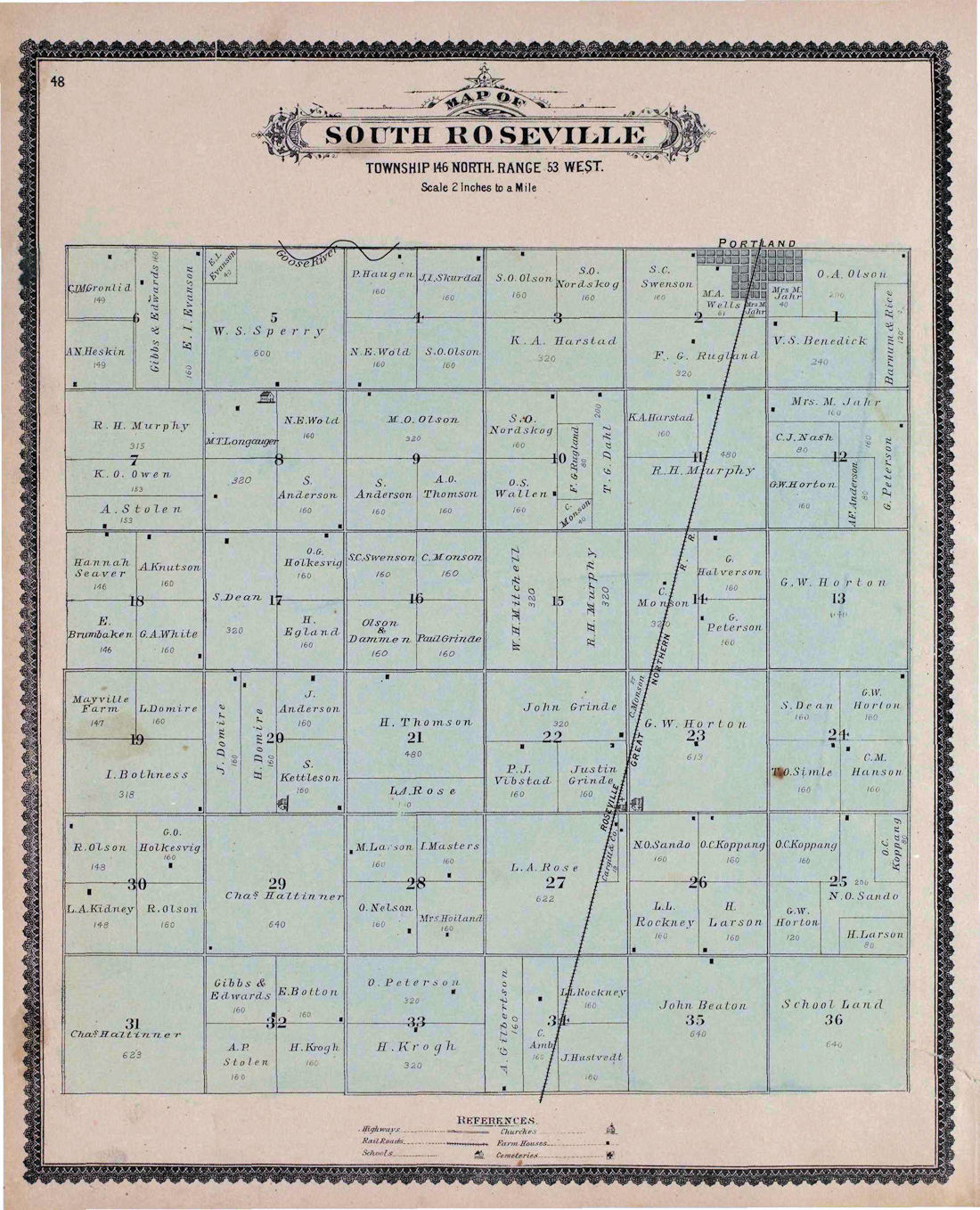
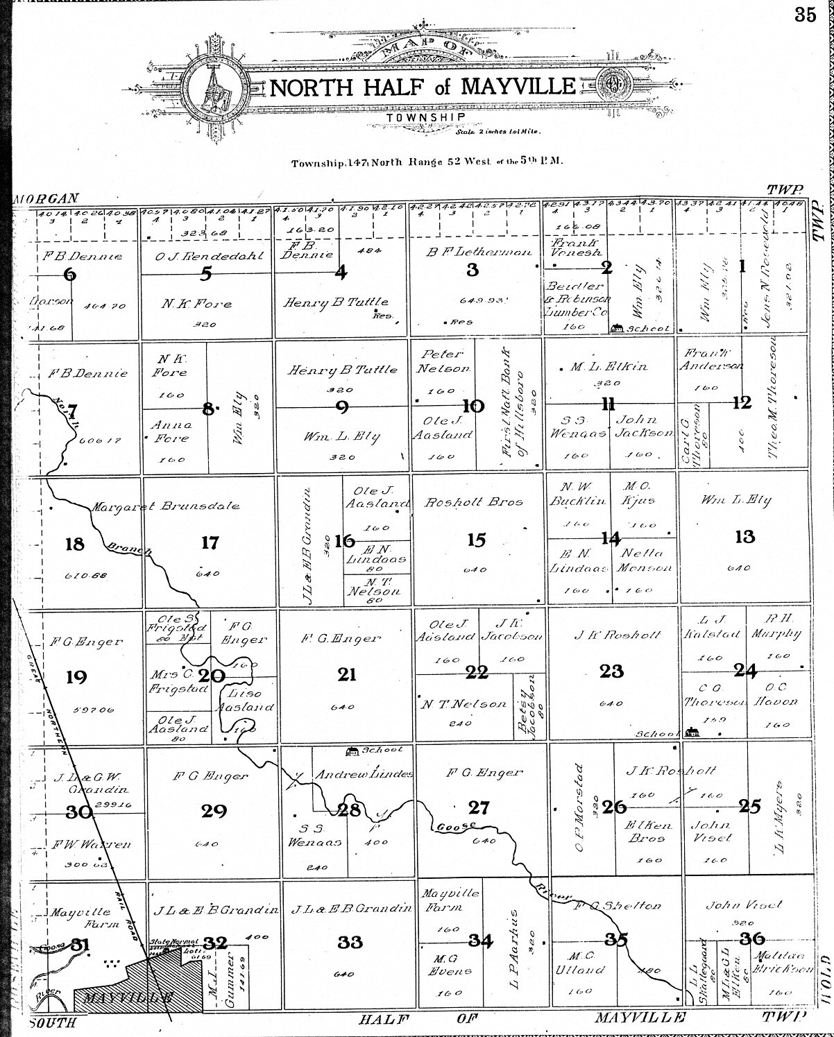
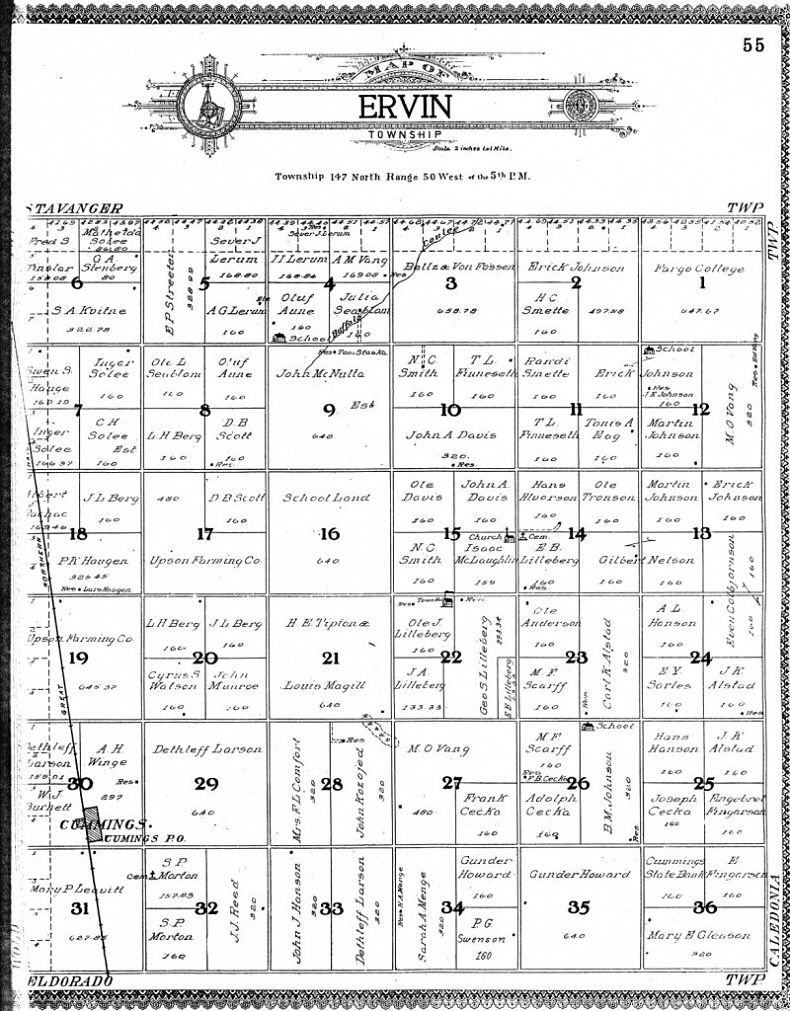
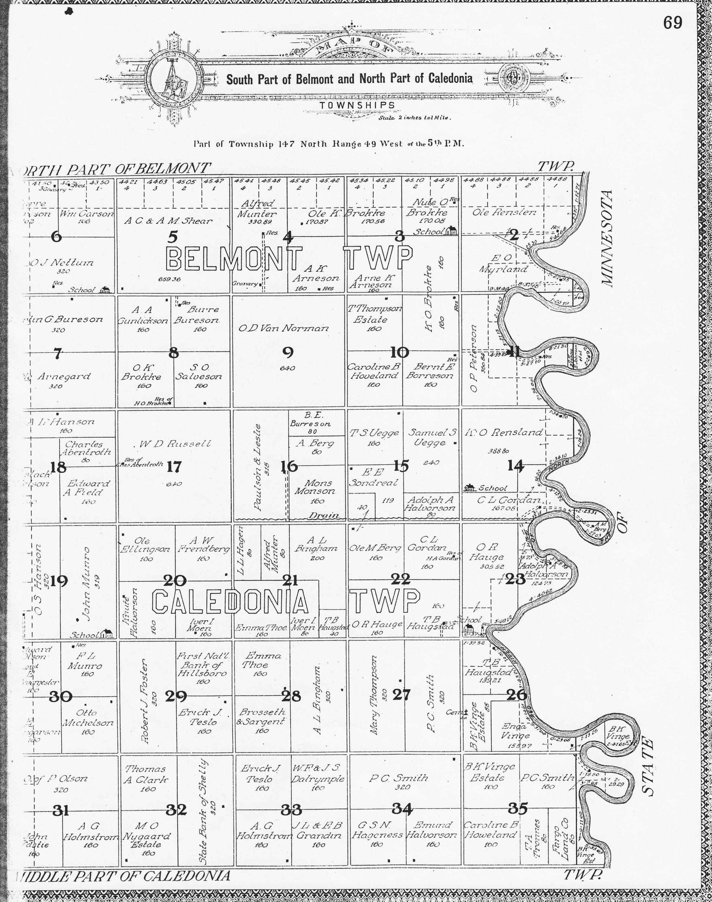
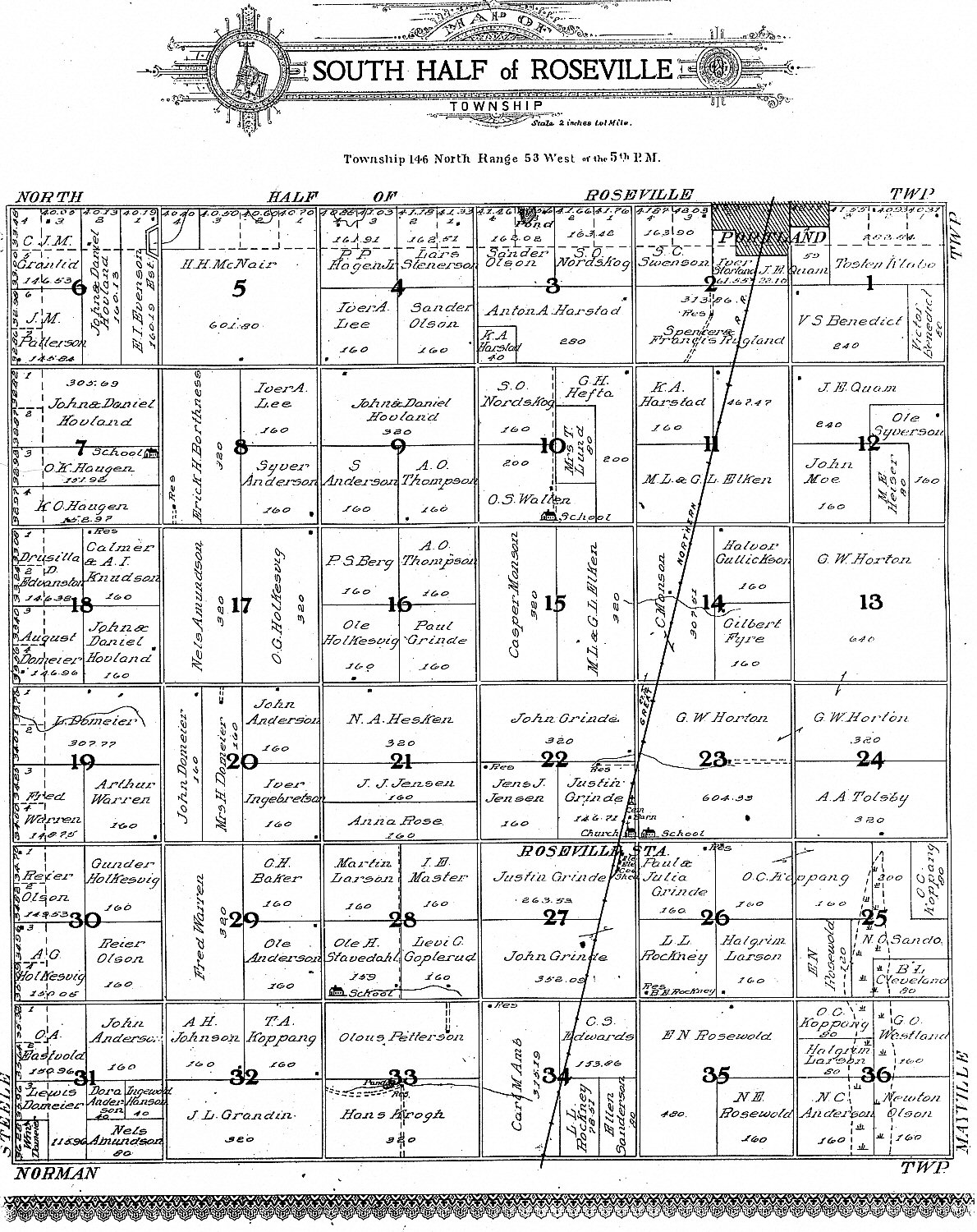
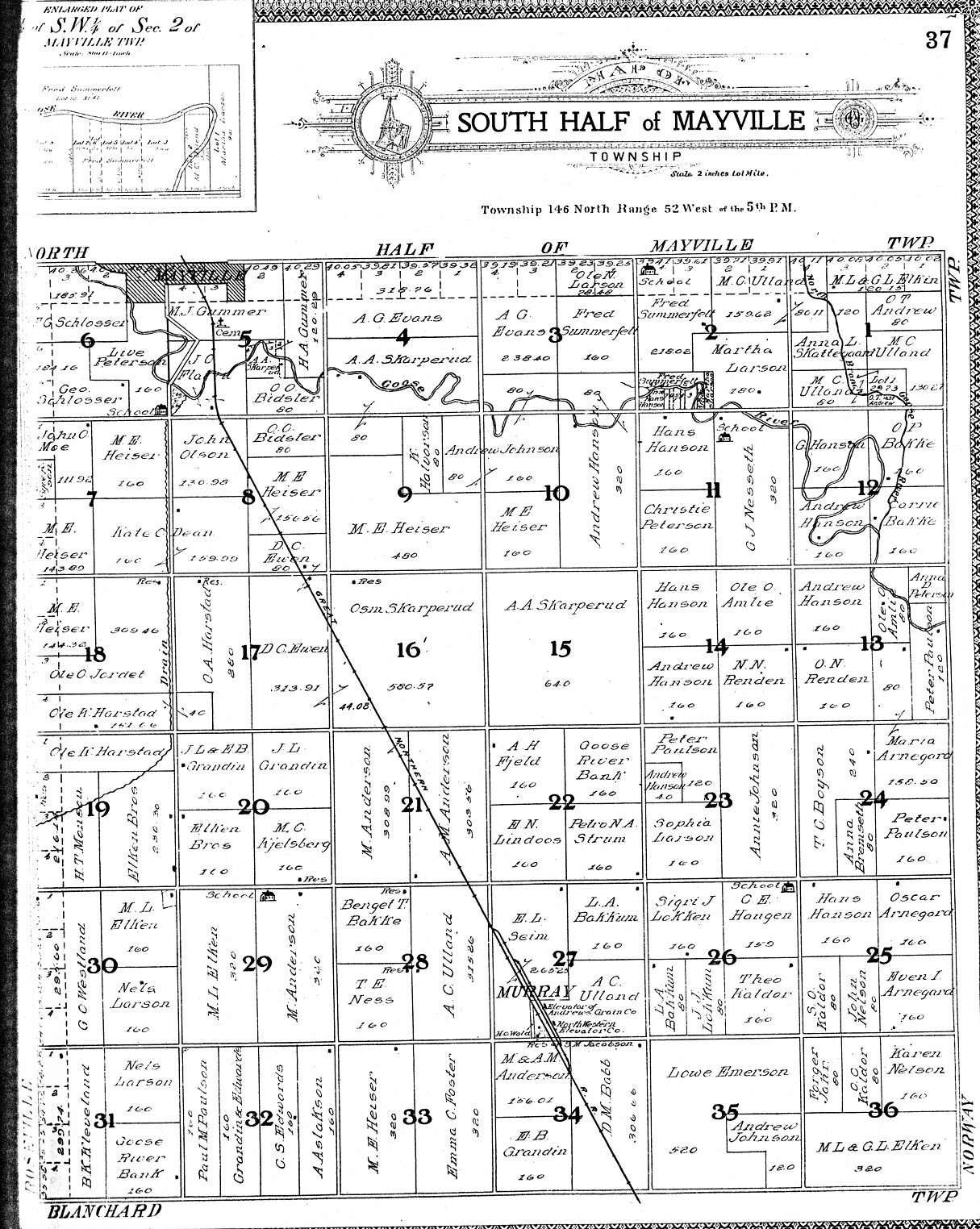
| North Roseville | North Mayville | Logan | Ervin | S. Belmont/N. Caledonia |
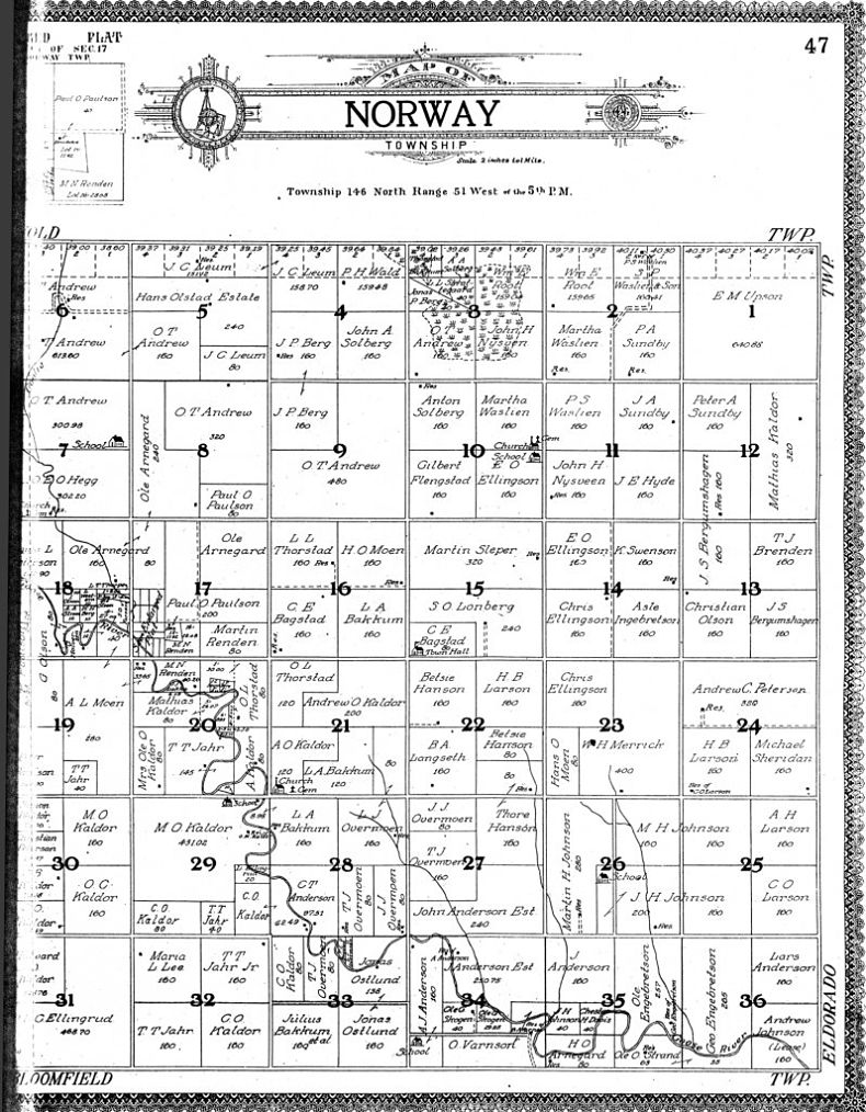
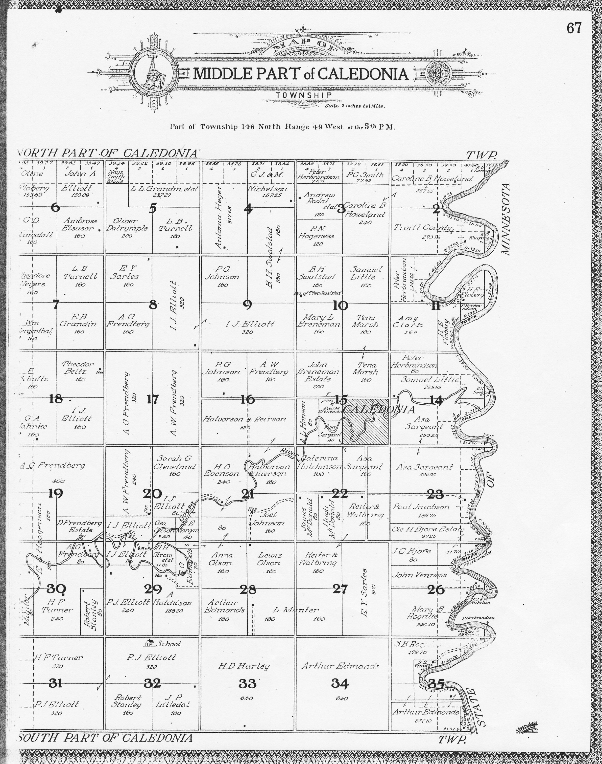
| South Roseville | South Mayville | Norway | Eldorado | Middle Caledonia |
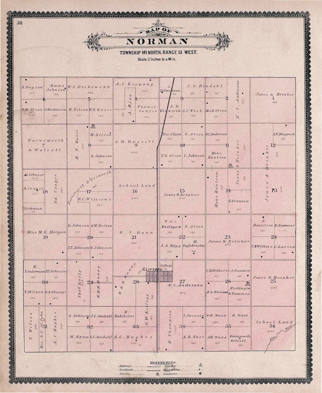
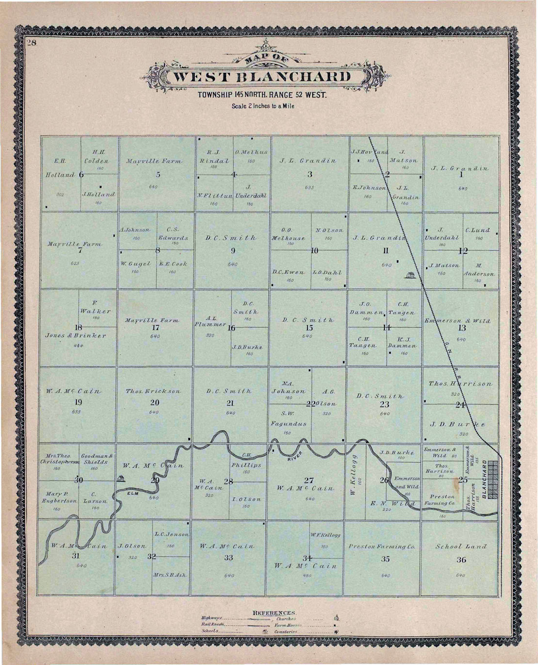
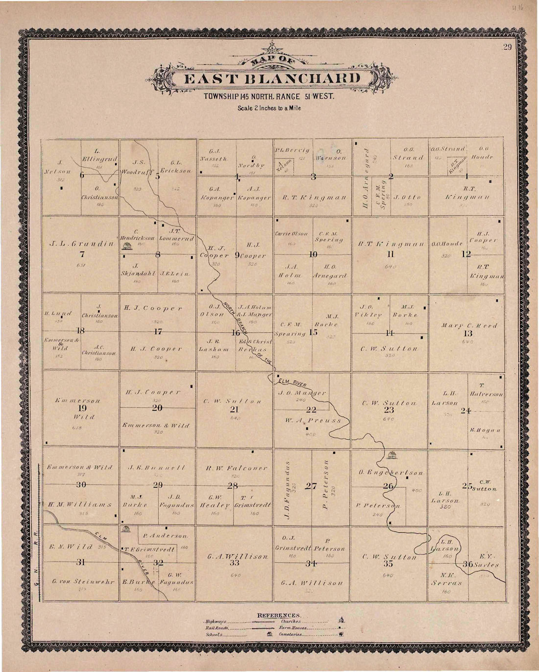
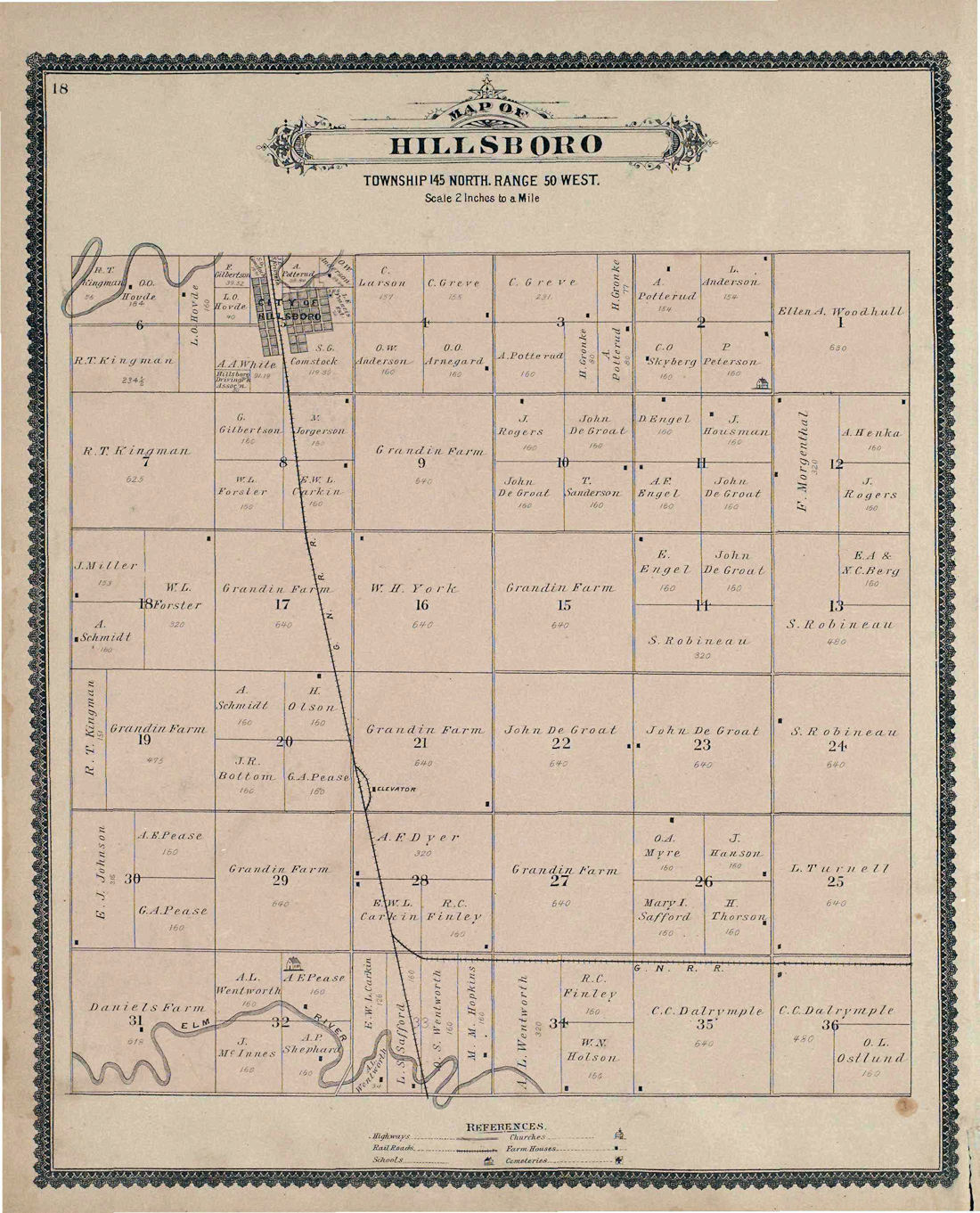
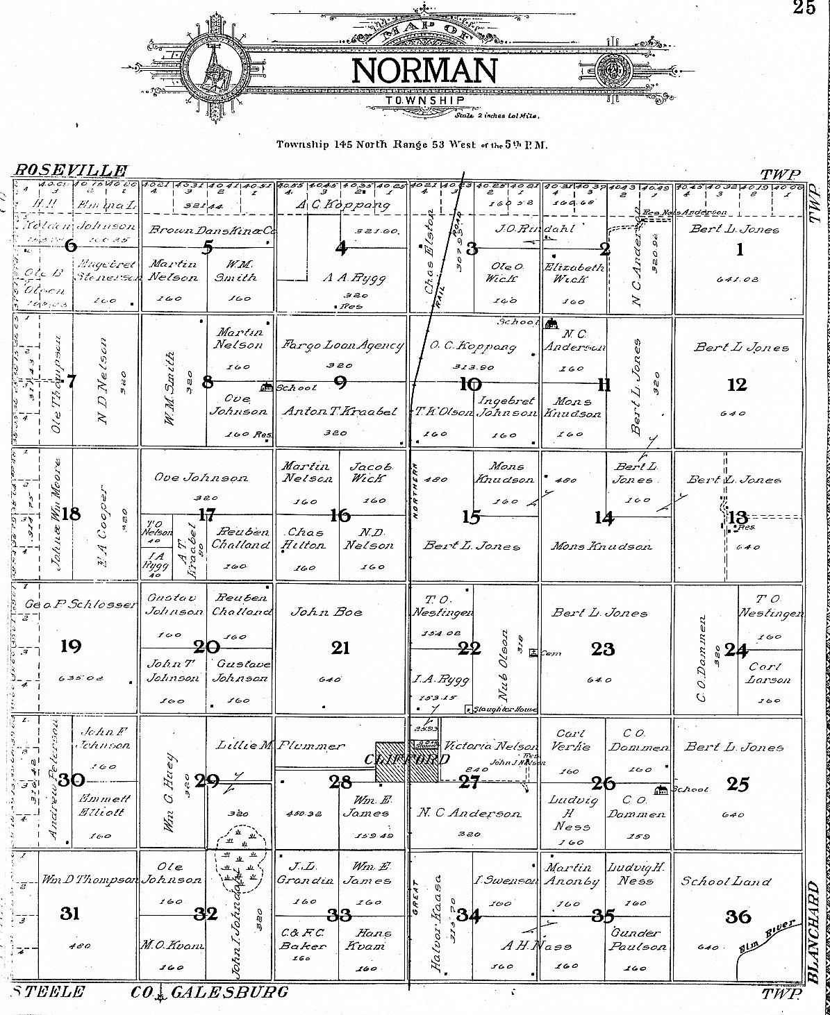
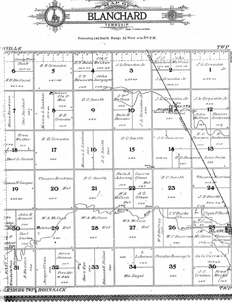
| Norman | West Blanchard | East Blanchard | Hillsboro | South Caledonia |
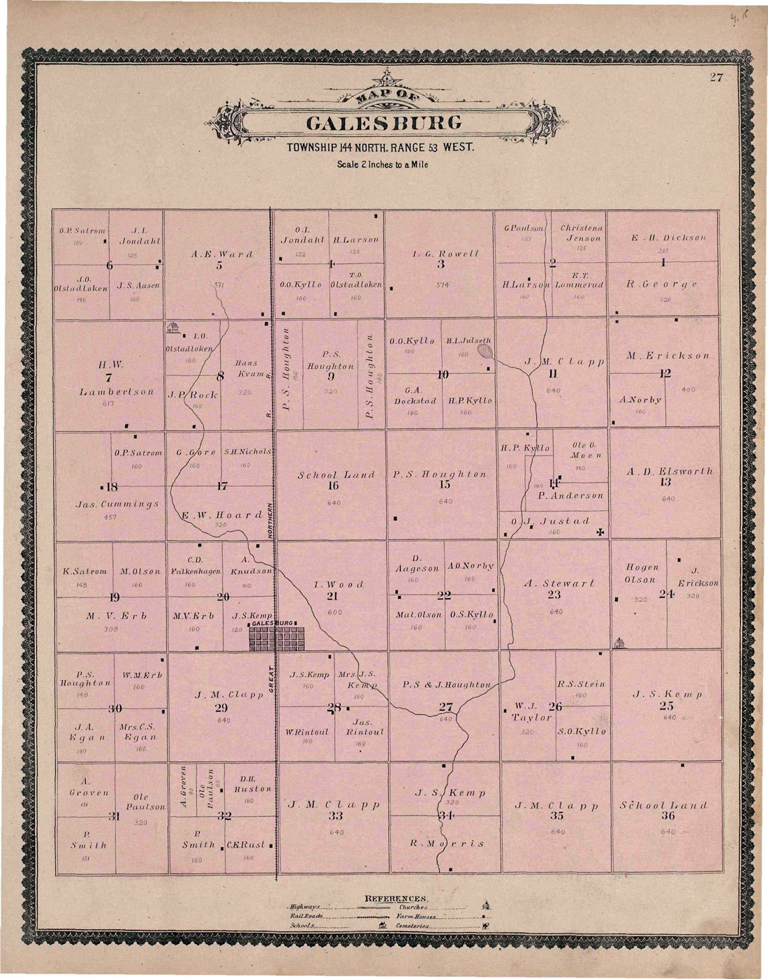
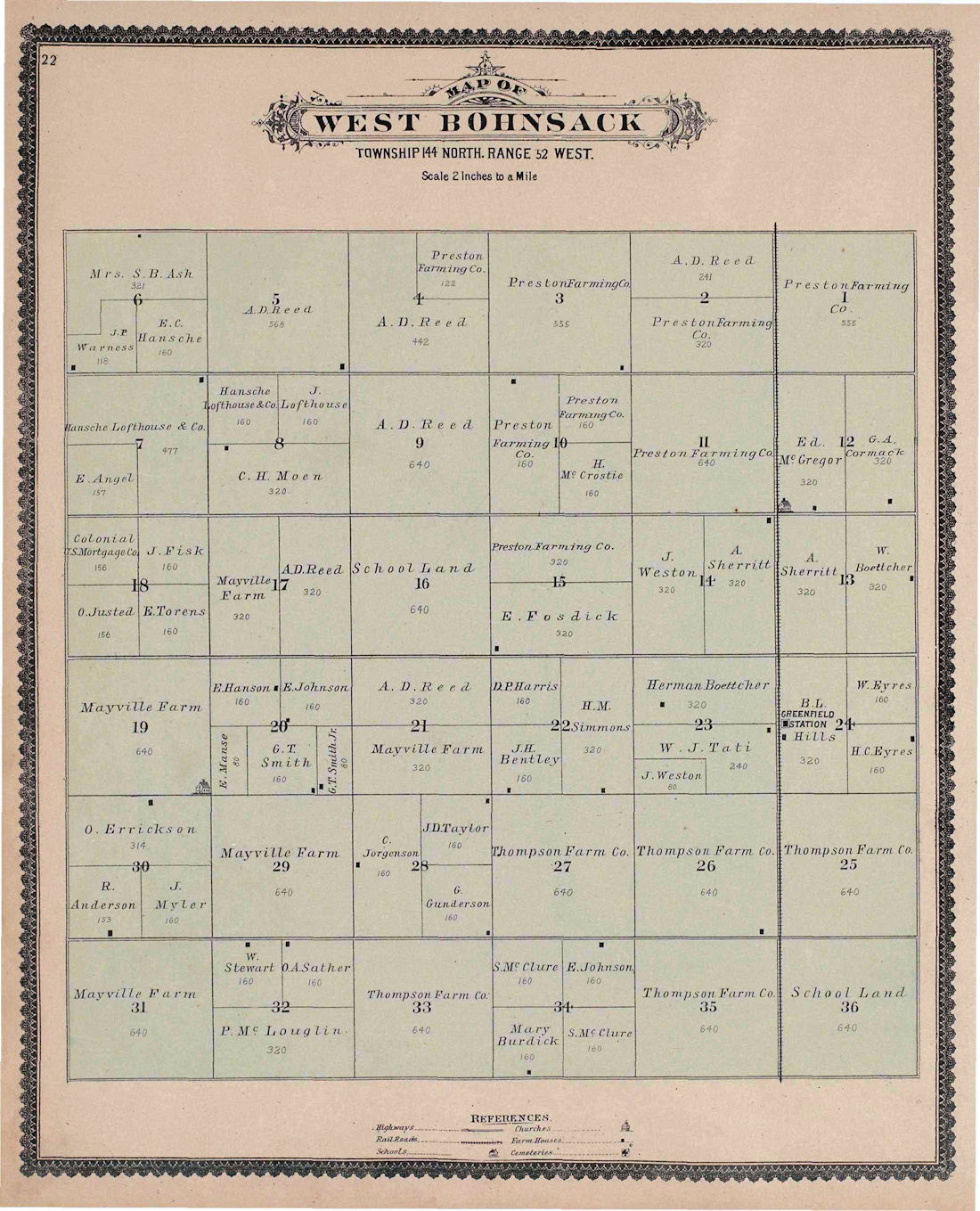
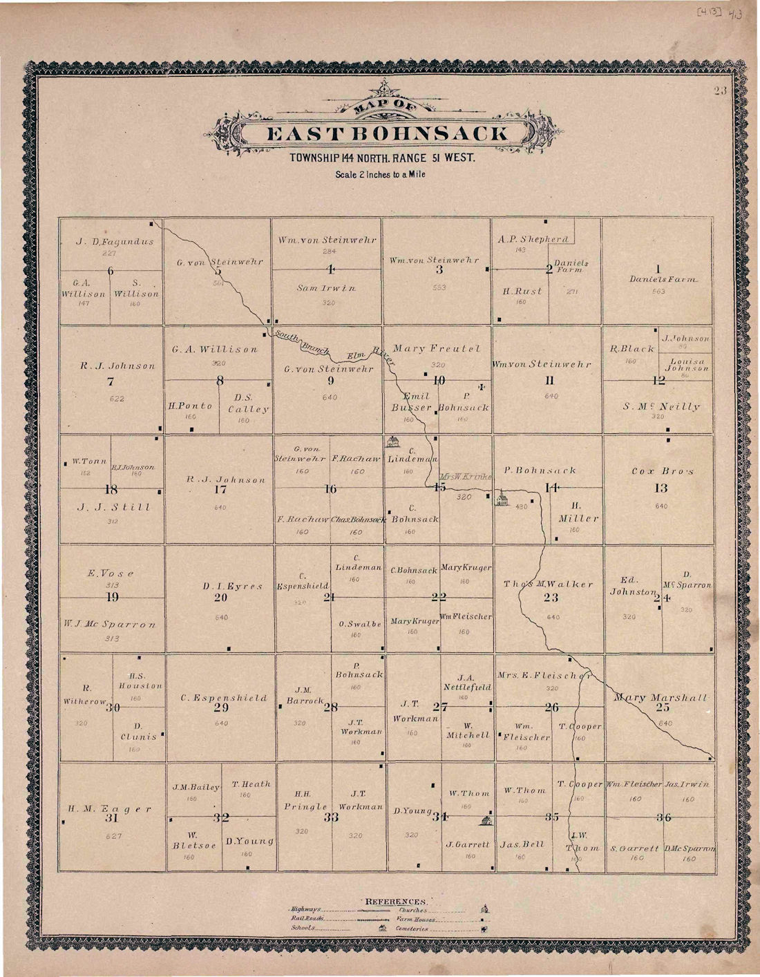
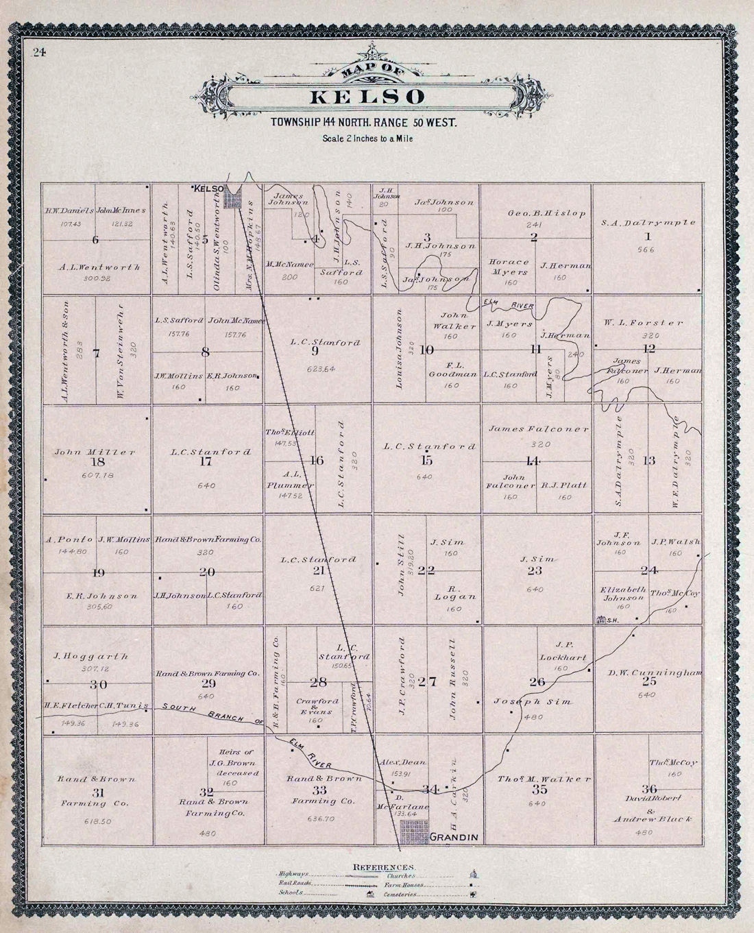
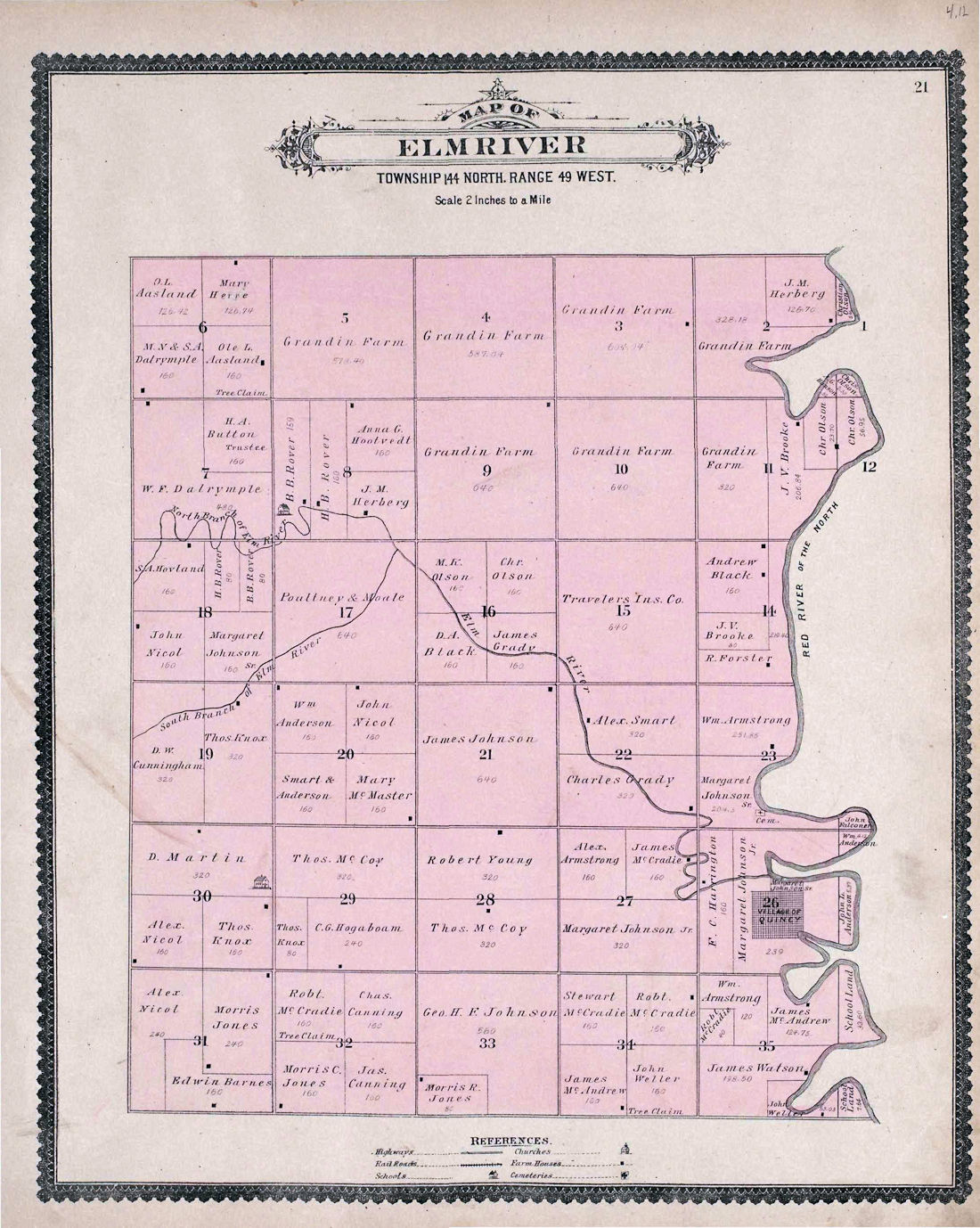
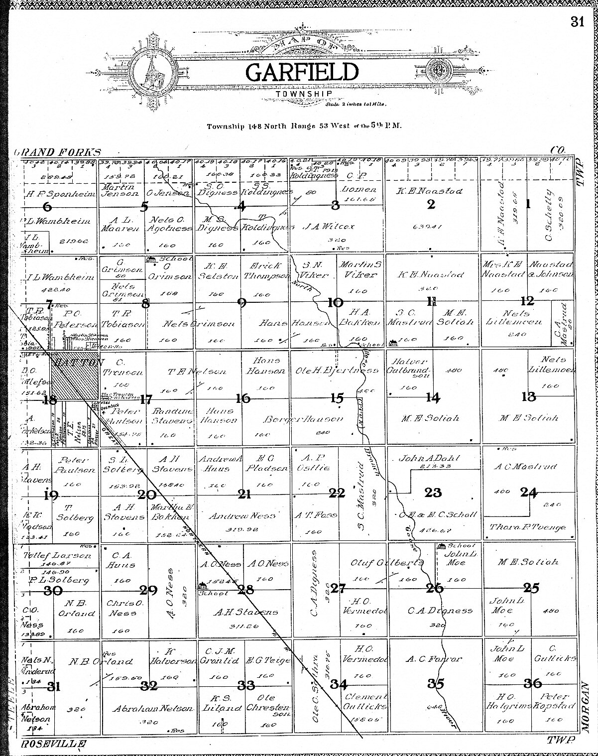
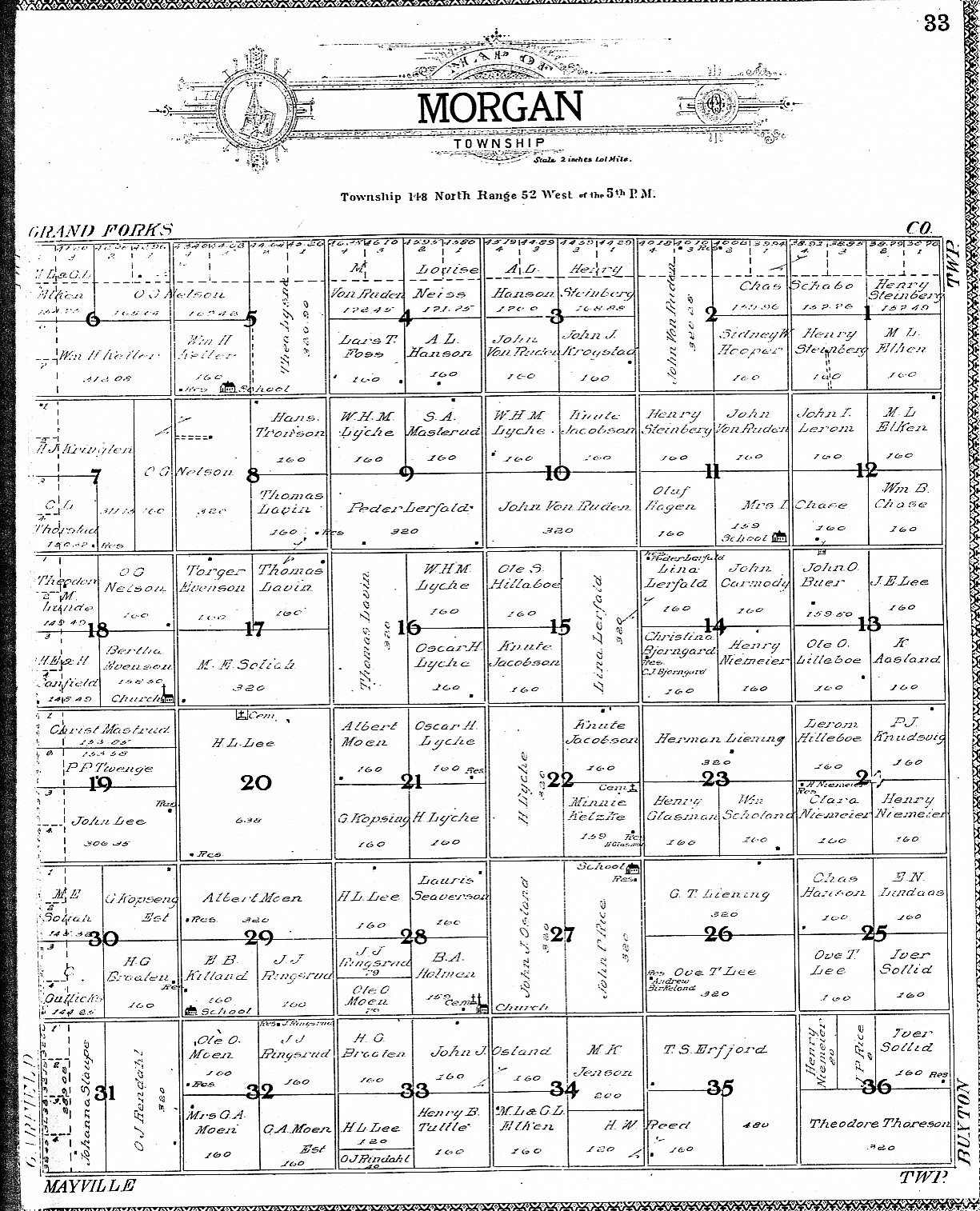
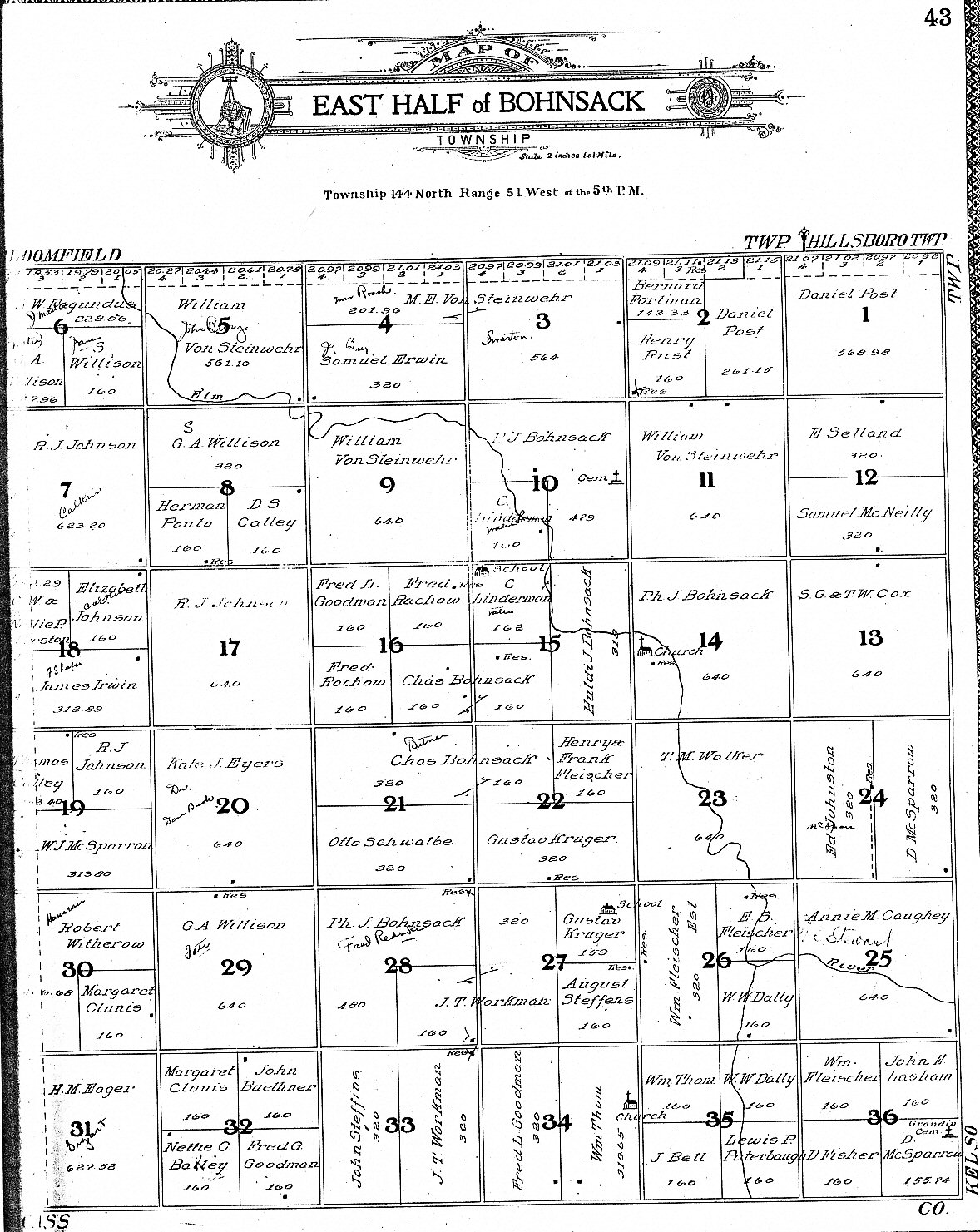
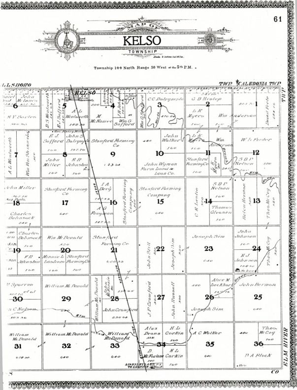
| Galesburg | West Bohnsack | East Bohnsack | Kelso | Elm River |
|
1900 |
||||
| Complete County | ||||
|
Undated - After 1900, Before 1909 Herberg Township (Not on Here) Established 1909 |
||||
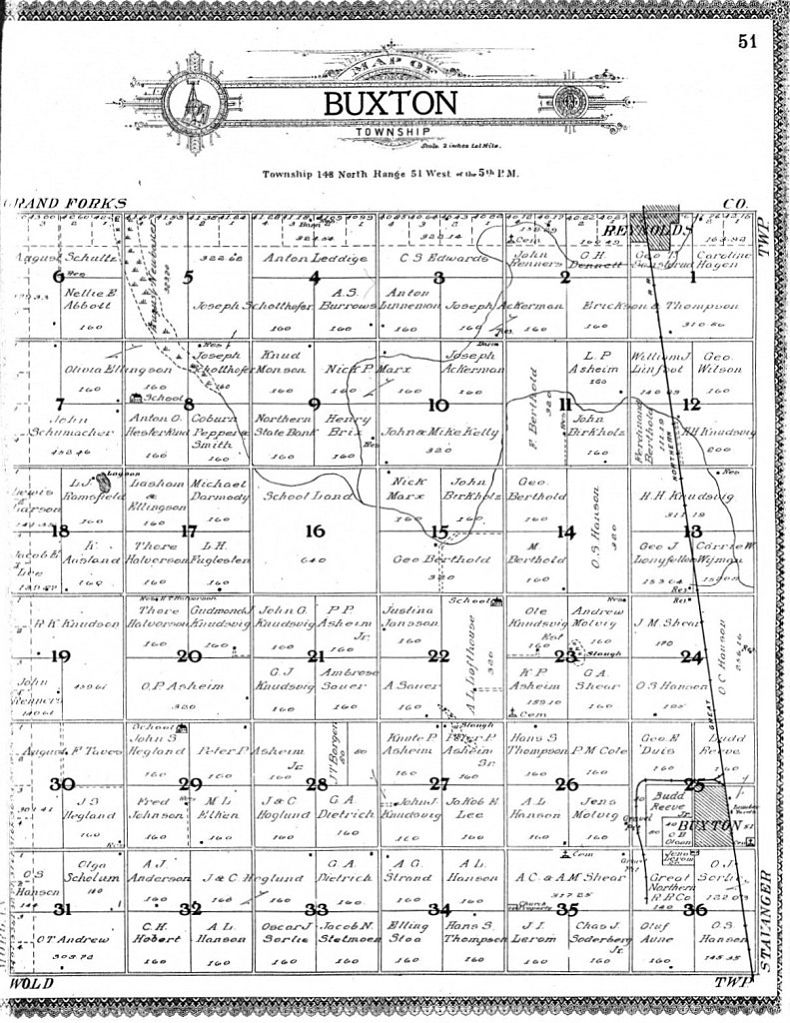
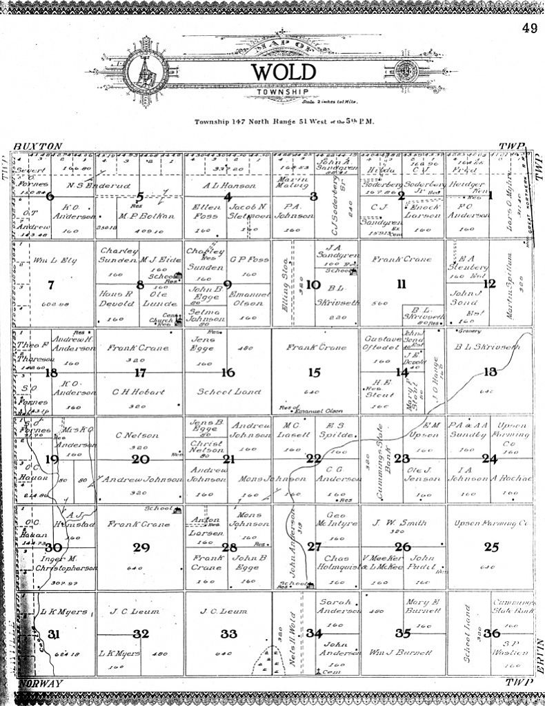
| Garfield | Morgan | Buxton | Stavanger | North Belmont |
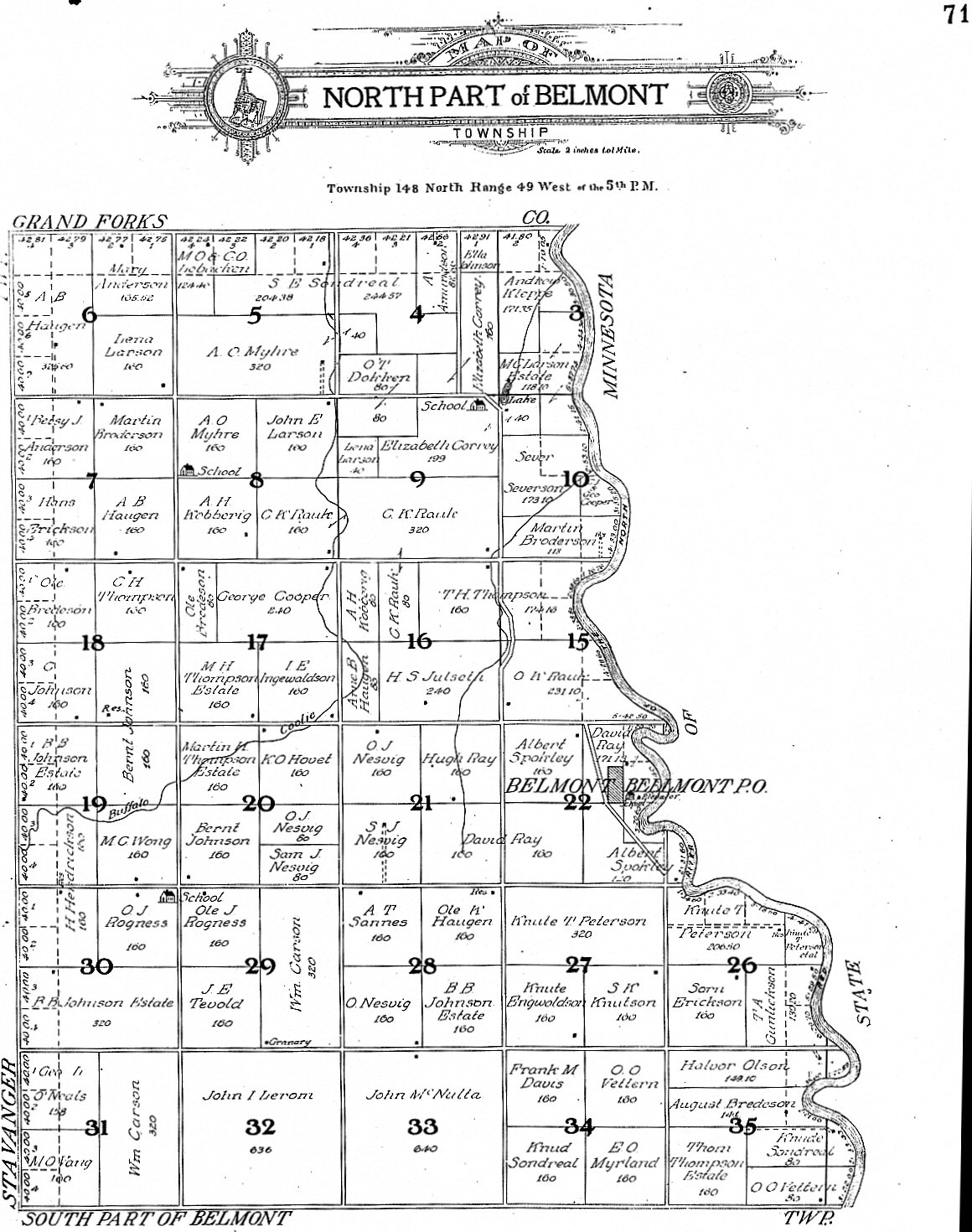
| North Roseville | North Mayville | Wold | Ervin | S. Belmont/N. Caledonia |
| South Roseville | South Mayville | Norway | Eldorado | Middle Caledonia |
| Norman | Blanchard | Bloomfield | Hillsboro | South Caledonia |
| Galesburg | West Bohnsack | East Bohnsack | Kelso | Elm River |