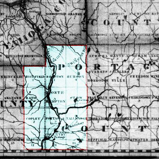
Fire Lands Map
Western Reserve and the Firelands Map
Creator Pitt, Savery and Sumner, William
Date of Original 1826

The Townships that are to become Summit County are highlighted. The Townships of Green and Franklin are part of the Congress Lands, and it shows both East Akron, and Middlebury that will become Akron.
Summit County OHGenWeb Page
Established November 20, 1996
Copyright Notice: All files on this site are copyrighted by their creator. They may be linked to but may not be reproduced on another site without specific permission from Mary Ann Hetrick and/or their contributor. Although public information is not in and of itself copyrightable, the format in which they are presented, the notes and comments, etc., are. It is however, quite permissable to print or save the files to a personal computer for personal use ONLY.
Copyright © 1998-2010, Mary Ann Hetrick
& the Summit County OHGenWeb.
Outter Background Copyrighted © 2006 by: EOS Developers.com
Released for free under a Creative Commons Attribution 2.5 License


