Townships and Ranges
How to find your land:
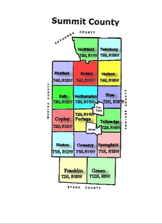
Original land patents and old deeds often describe the location of lands by Range, Township, Section, and Quarter sections mapped under provisions of the Northwest Ordinance enacted on 13 July 1787. To determine where the land mentioned in a deed is located you must know where each Range, Township and Section are located. The Map below shows the Township and Range numbers for each township in Summit County to help you determine where your ancestor's land was located.
All of the townships in Summit County were part of the Connecticut Western Reserve survey, except for the townsips of Green, and Franklin. The townships of Green and Franklin were part of the Congress Lands survey.

Summit County OHGenWeb Page
Established November 20, 1996
Copyright Notice: All files on this site are copyrighted by their creator. They may be linked to but may not be reproduced on another site without specific permission from Mary Ann Hetrick and/or their contributor. Although public information is not in and of itself copyrightable, the format in which they are presented, the notes and comments, etc., are. It is however, quite permissable to print or save the files to a personal computer for personal use ONLY.
Copyright © 1998-2010, Mary Ann Hetrick
& the Summit County OHGenWeb.
Outter Background Copyrighted © 2006 by: EOS Developers.com
Released for free under a Creative Commons Attribution 2.5 License


