Fillmore County MNGenWeb Project
Fillmore County MN

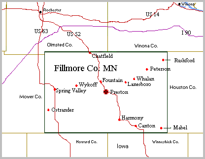
Fillmore County Maps

1858 Map of Fillmore Co.

1895 Map of SE Minnesota

Gailbraths Railway Map

Fillmore County is rectangular in shape, consisting of 24 townships, most of which are themselves rectangles, measuring 6 miles by 6 miles. The county is 24 miles north to south and 36 miles west to east. That's 864 square miles or 553,082 acres. Fillmore is bordered on the north by Winona and Olmsted Counties, to the east by Houston County, to the west by Mower County, and to the south by the Iowa counties of Howard and Winneshiek.

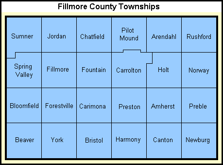
Each of the 24 Fillmore County townships is divided into sections, with most townships having 36 sections that are 1 mile x 1 mile. Sections in each township are numbered thusly:

6 5 4 3 2 1
7 8 9 10 11 12
18 17 16 15 14 13
19 20 21 22 23 24
30 29 28 27 26 25
31 32 33 34 35 36

US Digital Map Library
Link to Digitized State of Minnesota Plat Book -- 1916.
Click on a county to bring up a map showing the townships. Click again for more detail, including who the land owners were when this book was put together in 1916.