Maps of Dickey County, North Dakota
If anyone has another map of Dickey County or one showing a particular part of the county or a town that you'd like to share, I'd be happy to post it here or create a link. Please contact .
- Map of Dickey County by Microsoft Streets 2000
- Township Map of Dickey County and Information About Surveys of Public Lands
- 1884 Map of Dickey County - west half and east half
(Courtesy of Alison Ligman -Feb 2004)
Most of the townships then were grouped into 16 units and only 12 of the units had names.
- Historical Maps from the 1884 Andreas Atlas (Courtesy of Alison Ligman -Feb 2004) Be sure to check the Localities Page for a location of interest.
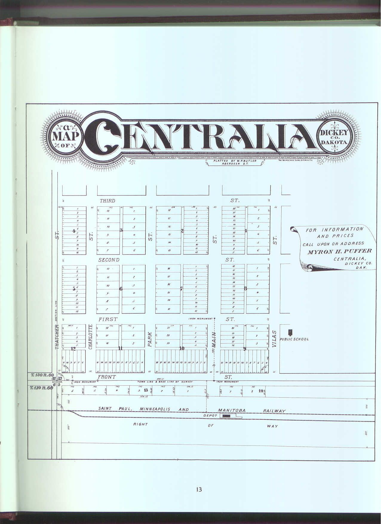
- Centralia (later known as Guelph)
- Eaton
- Hudson
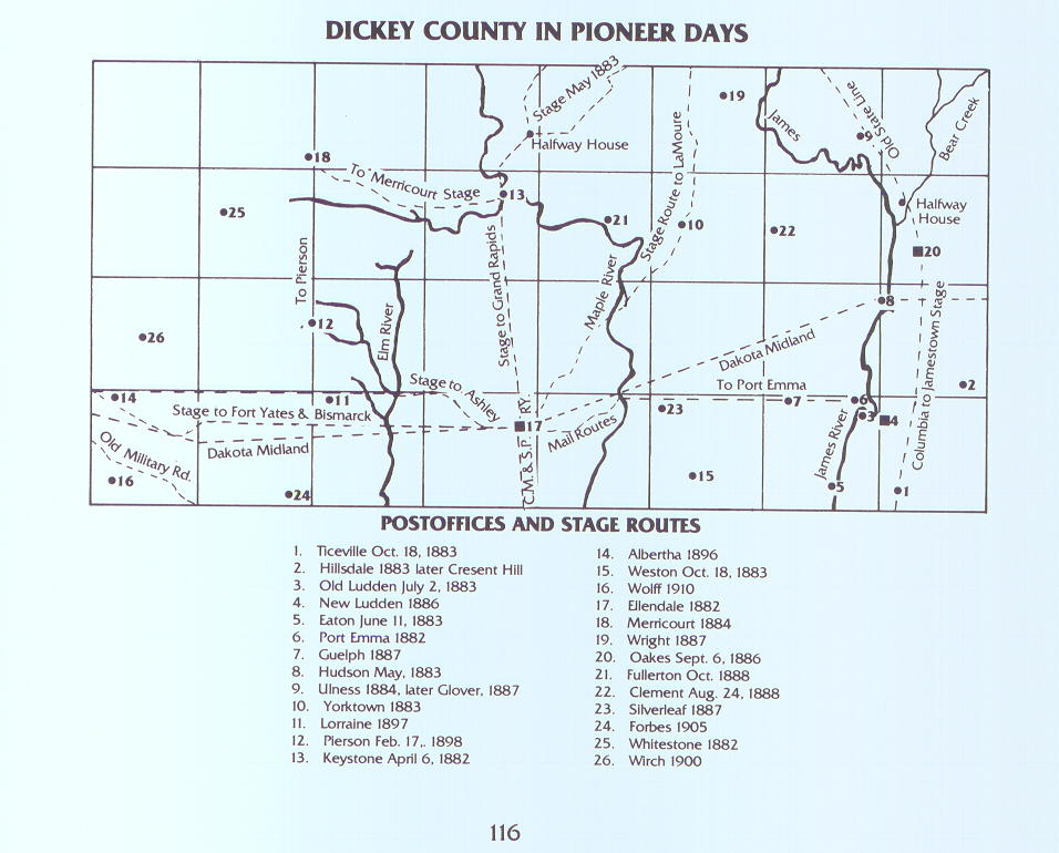
- Dickey County in Pioneer Days showing post offices and stage routes. (Courtesy of Alison Ligman -Feb 2004)
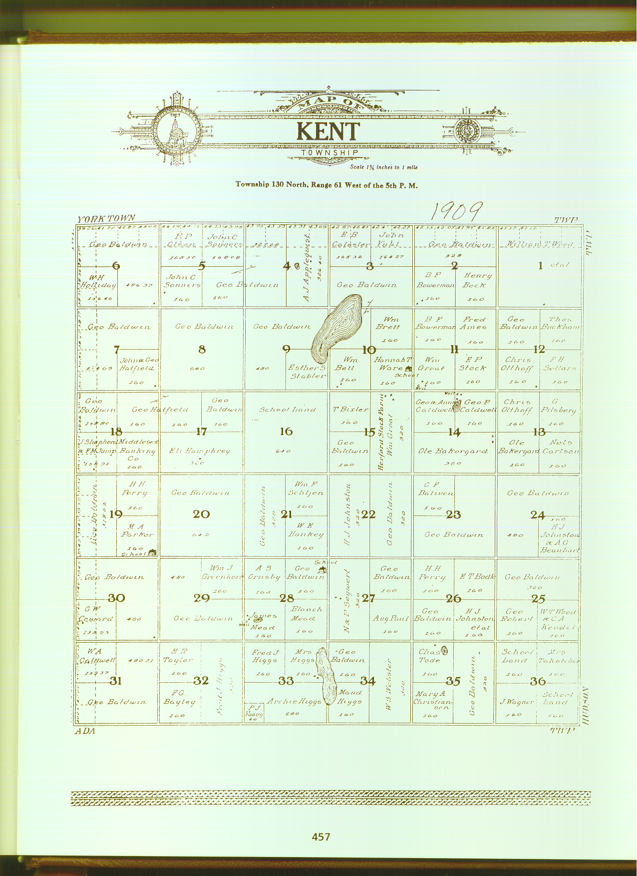
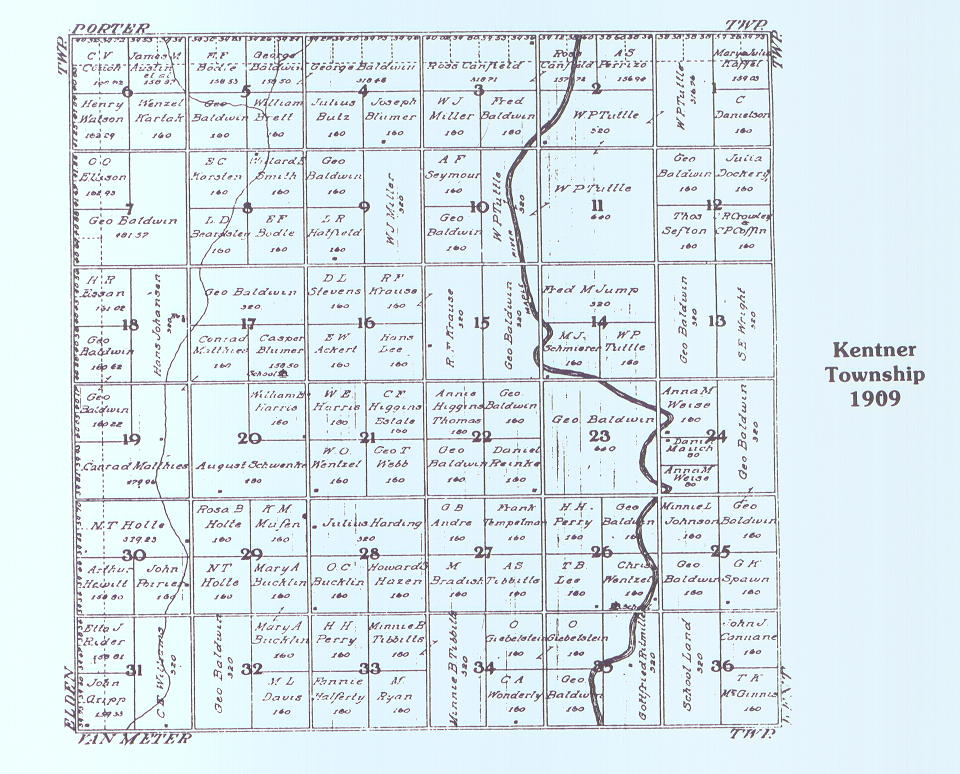
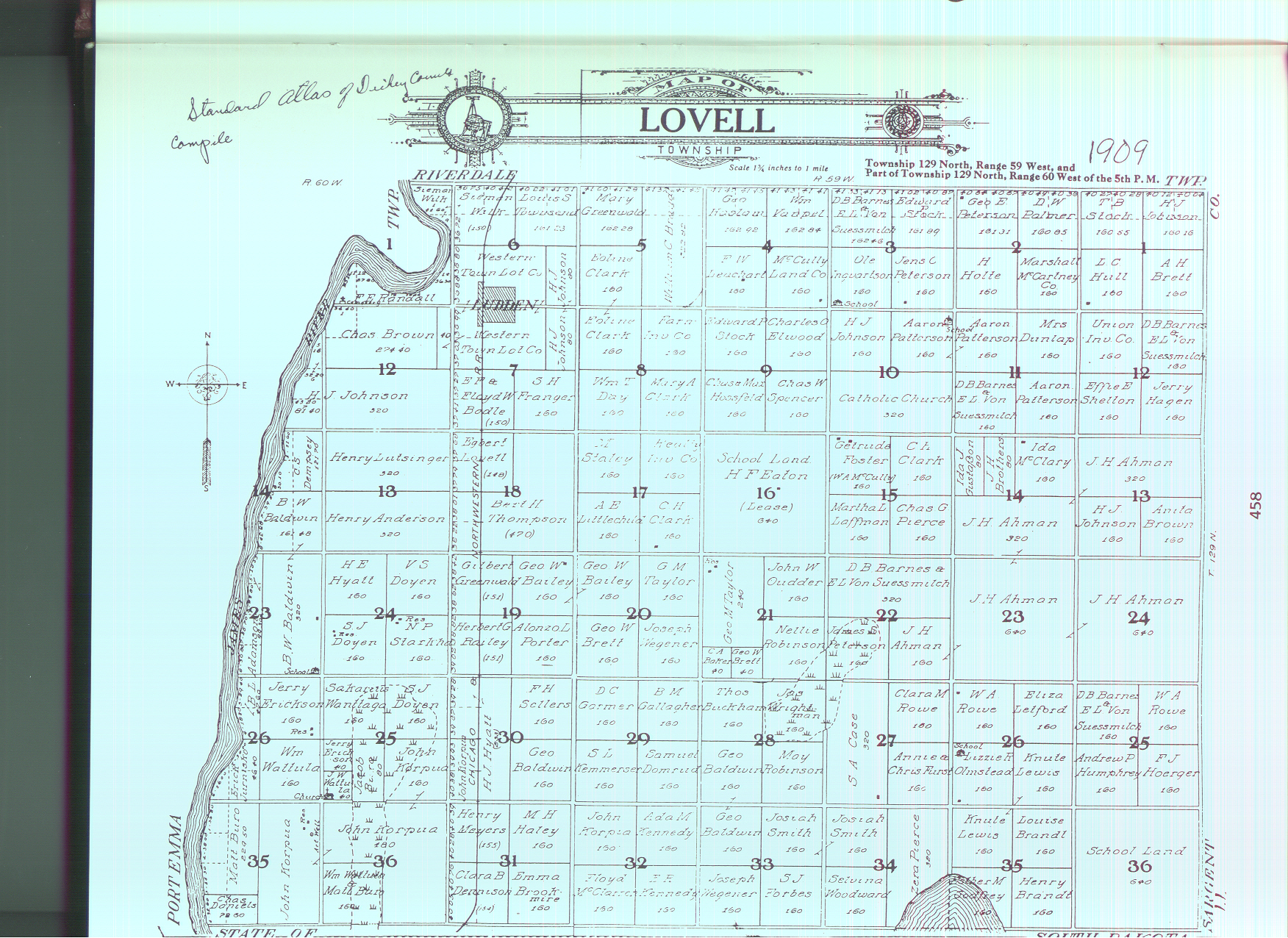
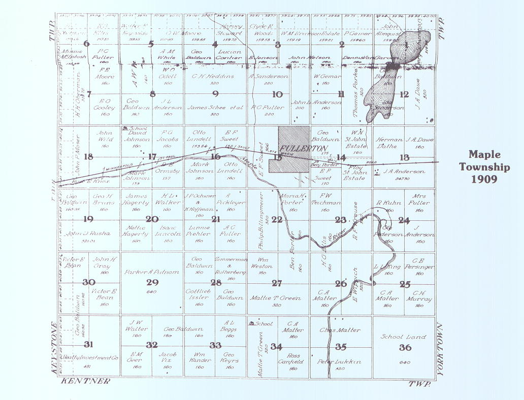
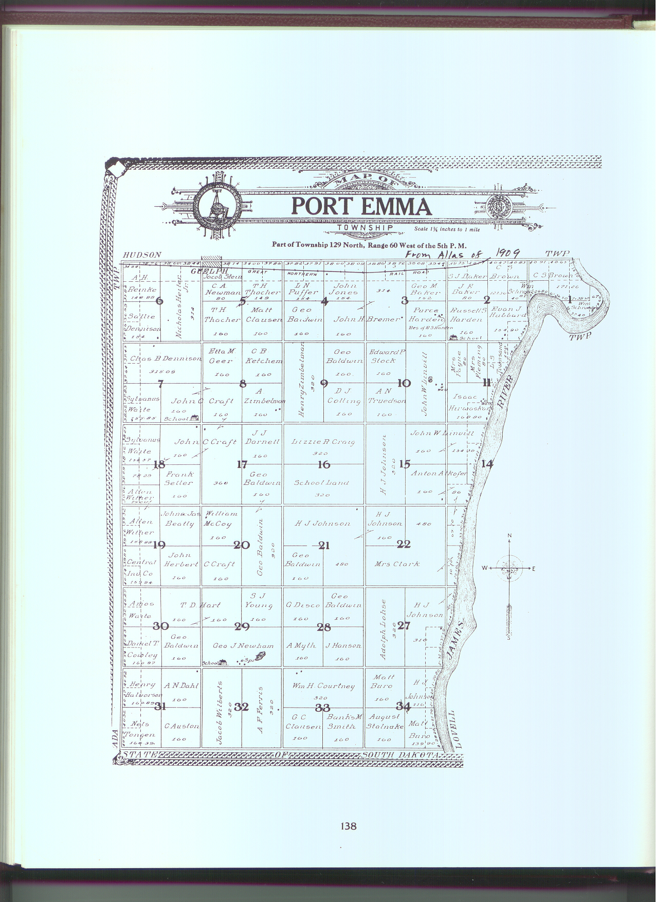
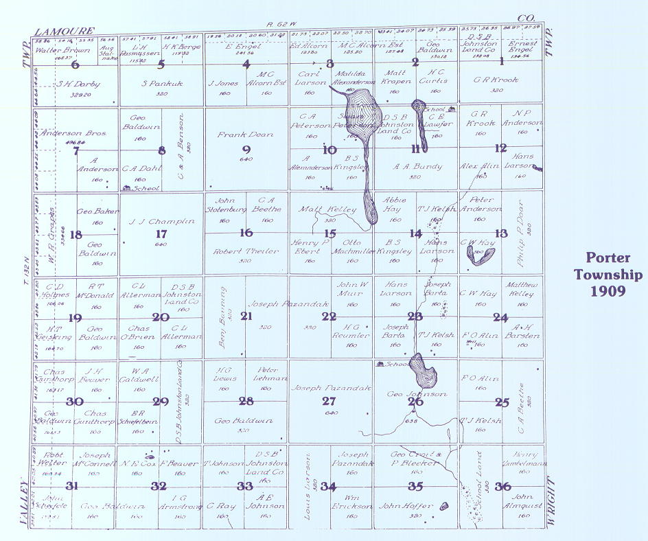
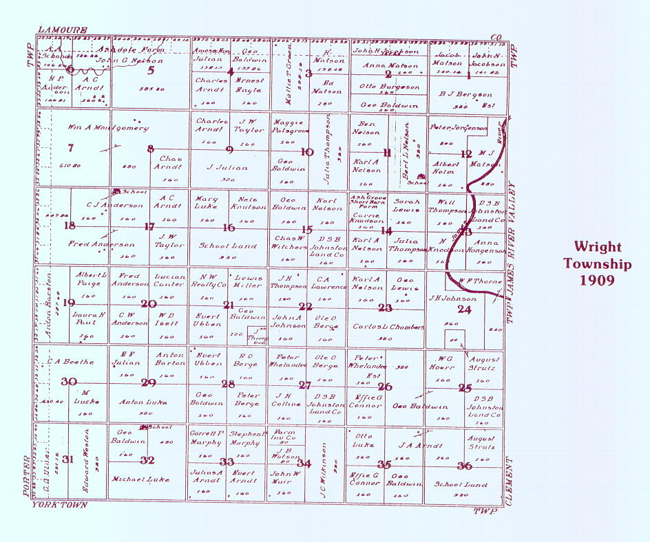
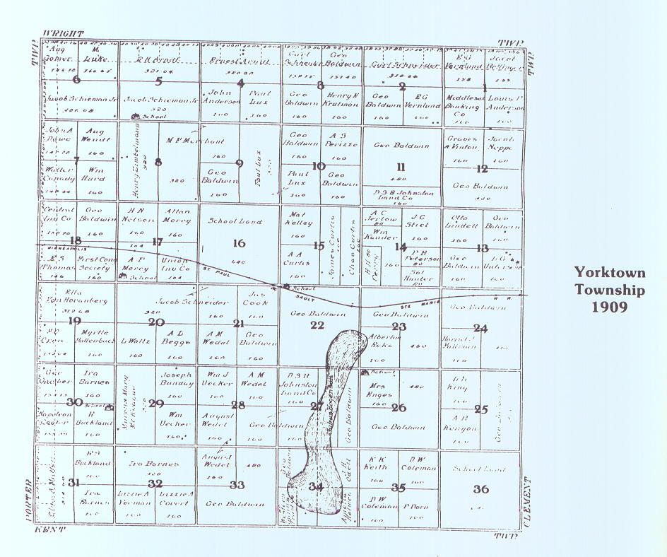
- 1909 Plat Maps of Dickey County - Landowners are shown. (Courtesy of Alison Ligman -Feb 2004)
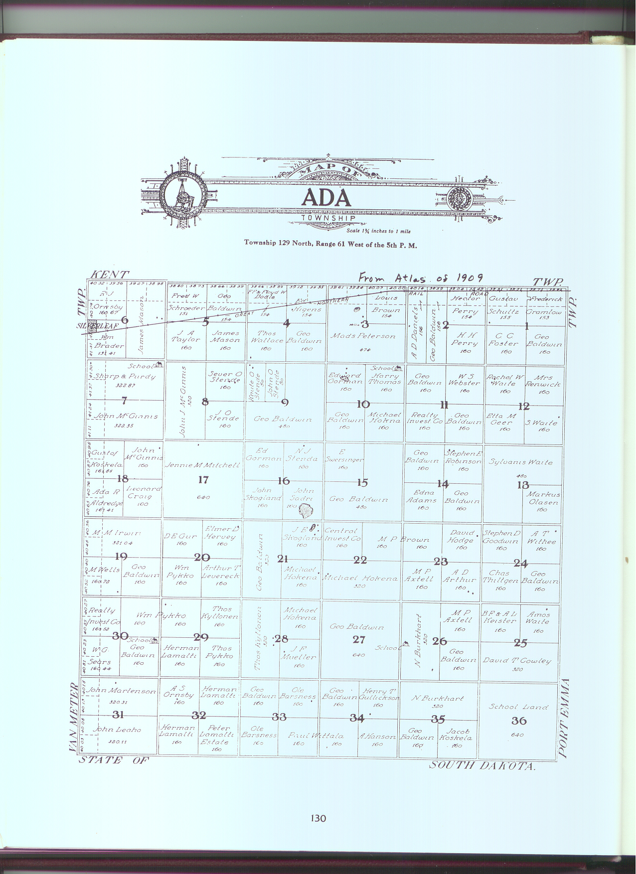
- Ada Township
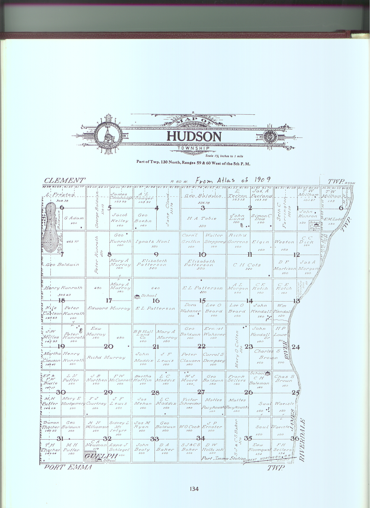
- Hudson Township
- KentTownship
- KentnerTownship
- Lovell Township
- Maple Township
- Port Emma Township
- Porter Township
- Wright Township
- Yorktown Township
Here's a link to an online index of the 1909 Plat Maps of Dickey County. The name index is followed by the list of townships and their respective coordinates. It's a little tricky coordinating the index to the maps so if you'd like help, please contact .
From the online index use your BACK button to return to this page.
- Here's a link to a 1914 map of Dickey county. From this off-site map use your BACK button to return to this page.
- 1928 Map of Dickey County Showing Township Sections. This is a bit hard to read but when you're looking at deeds, a map like this is helpful when trying to visualize the legal description.
© Copyright 2002-2017
Dickey Co., NDGenWeb Coordinator