

Nelson County
NDGenWeb

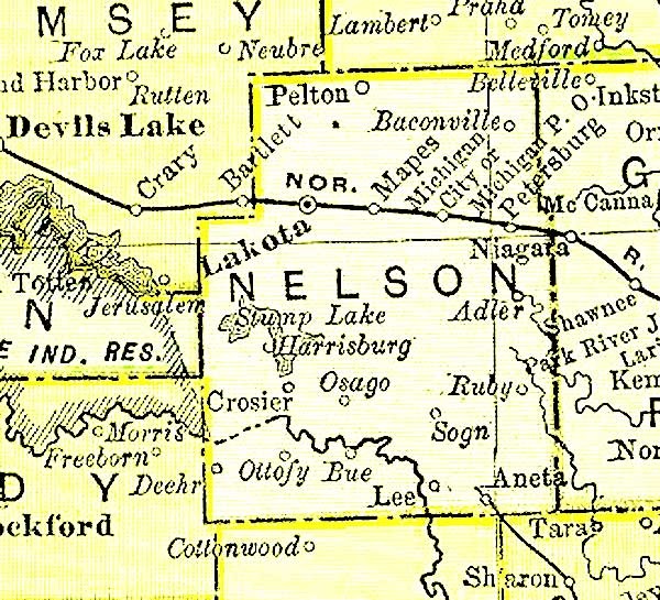
1895 Rand McNally Atlas map
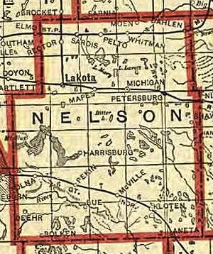
1911
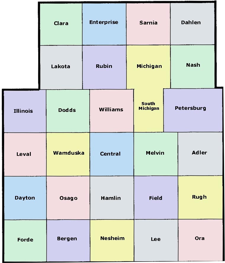
Townships
Nelson county is located in the eastern part of the state, about 40
miles from the eastern boundary line, in what is known as "The Famous
Wheat and Flax Belt."
Nelson county has long been regarded one of
the very best counties in the state. It is bordering on the Red River
Valley and one year with another has had better average crops than the
Red River Valley. In 1895 it led all the state with an enormous average
yield of 25 bushels of wheat per acre.
The surface is a gently
rolling prairie, covered in its natural state with a rich growth of most
nutritious grasses.
Besides many small lakes, we have Stump Lake,
or Lake Wamduska, the second in size in the state; a beautiful and
romantic sheet of water 15 miles in length, whose waters are fast
becoming famed for their medicinal properties, a delightful resort for
bathing, boating and hunting.
The Sheyenne River, the principal
stream, flows through the southern part of the county. It abounds in
fish of various kinds, and along its fertile valley, and on the shores
of the lakes, are beautiful groves of natural timber. Cultivated trees
also do well, with proper care, and scattered over the county are many
groves platted by the hand of man.
Extracted from Lakota, North Dakota, published in 1901, pages 4-6.
Adler
Bergen
Central
Clara
Dahlen
Dayton
Dodds
Enterprise
Field
Forde
Hamlin
Illinois
Lakota
Lee
Leval
Melvin
Michigan
Nash
Nesheim
Ora
Osago
Petersburg
Rubin
Rugh
Sarnia
Wamduska
Williams
Adler – historical
Aneta – named for Anna Roseta Mitchell, the postmaster's wife
Baconville – historical
Bue – historical
Crosier – historical
Dahlen
Harrisburg – historical
Kloten
Lakota – county seat
Lee – historical
Mapes - ghost town
McVille – pronounced "Mack-Ville"
Michigan City
Ottofy – historical
Pekin
Pelto – historical
Petersburg
Tolna
Wamduska – historical
Whitman
Copyright © 1996- The USGenWeb® Project, NDGenWeb, Nelson County
Design by Templates in Time
This page was last updated 04/18/2024