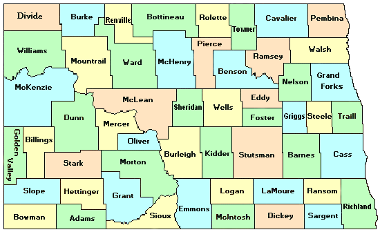
This first map below shows the current counties in North Dakota -- all color-coded.

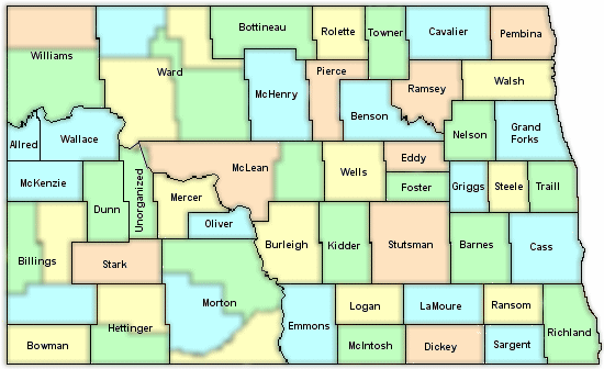
This map shows the counties that existed in 1895 and their boundaries. Current counties are still in the background by colors.

The North Dakota -- 1895 map was used as a guideline for creating this map.
|


