
Stark County History
The area now known as Ohio was originally Indian land (Erie, Huron, Ottawa, Tuscarora, Mingo, Delaware, Shawnee, and Miami) that was visited by Frenchmen like Robert Cavelier, sieur de La Salle between 1669 and 1670. As a result of La Salle's exploration and maps, France laid claim to the entire Ohio valley. The French and English fought for control of the area, and it wasn't until the War of 1812 that United States control was affirmed. The creation of the Northwest Territory by the Continental Congress on 13 July, 1787, and the passage of the Land Ordinance of 1785, which authorized the sale of mile square sections, led to greater development in Ohio. When the Federal requirement of 60,000 free adult males was met, Ohio became the first state admitted from the Northwest Territory in 1803.
Townships
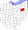
On 13 February, 1808 by an act of the State Legislature, Stark County was drawn from land originally in Columbiana County. It was organized on 1 January, 1809. Prior to 1815, Stark County consisted of eight townships - Canton, Green, Nimishillen, Osnaburg, Perry, Plain, Sandy, and Tuscarawas. The County was named after one of George Washington's Revolutionary War Generals, John Stark. Clicking on the township name below will take you to a list of the early settlers of that township.
- Bethlehem was incorporated 12 Dec 1816.
- Cantonwas organized 16 Mar 1809.
- Jackson township was created from Green and Tuscarawas on 1 Apr 1815.
- Lake was organized 4 Jun 1816.
- Lawrence was organized Dec 1815.
- Lexington was organized 4 Mar 1816.
- Marlboro was organized 4 Mar 1816.
- Nimishillen was organized 16 Mar 1809.
- Osnaburg was organized 16 Mar 1809.
- Paris was incorporated 1 April 1818.
- Perry was organized 26 Feb 1814.
- Pike (from Canton twp) was organized 6 Mar 1815.
- Plain was organized 16 Mar 1809.
- Sandy was organized 16 Mar 1809.
- Sugar Creek was organized 4 Mar 1816.
- Tuscarawas was organized 5 Mar 1810.
- Washington was organized 3 Dec 1821.
Note: Brown, Rose, and Harrison were created from Sandy township but reassigned to Carroll Co. Franklin and Green were reassigned to Summit County in 1840. Be aware that your ancestor may appear in Franklin Township, Stark County for instance, before 1840, and then appear in Summit County in 1850, even though they did not move.
Earliest Available Dates of Stark County Vital Records
- Birth - 1867
- Marriage - 1809
- Death - 1867
- Land - 1809
- Probate - 1810
- Court - 1809