

Mountrail County
NDGenWeb

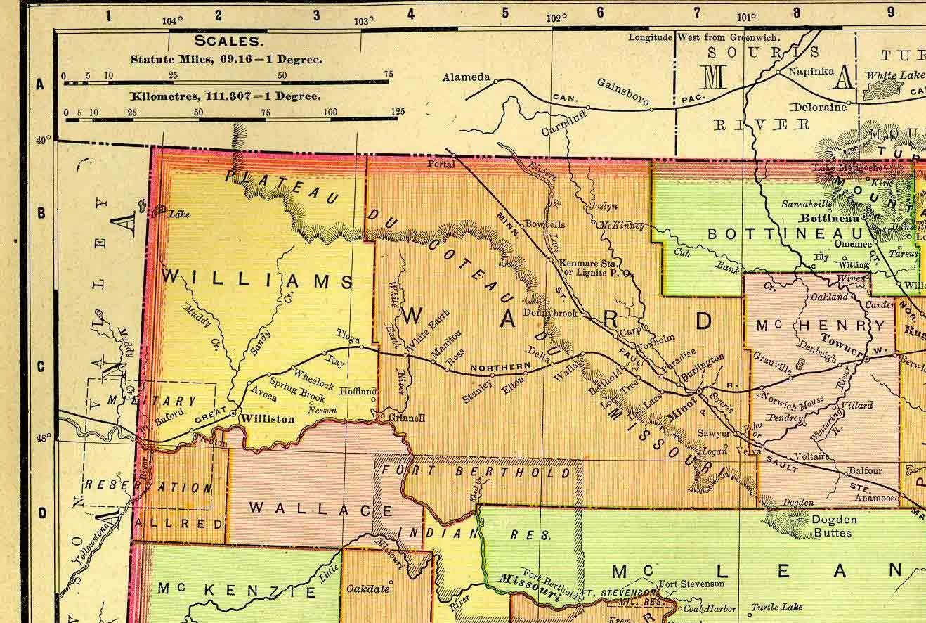
1895 Rand McNally Atlas map of the area
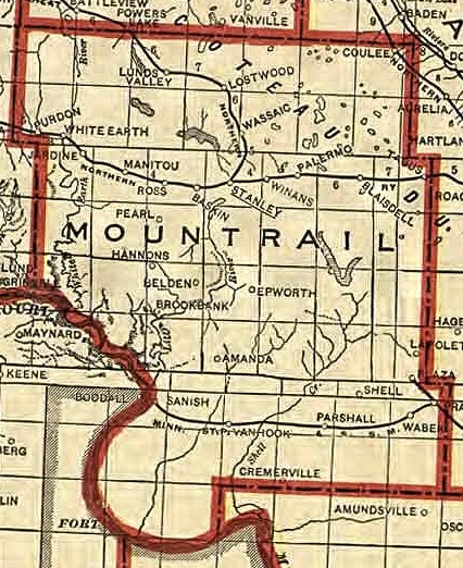
1911
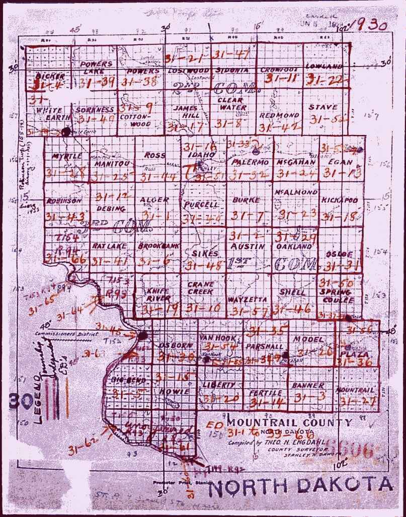
1930 Townships
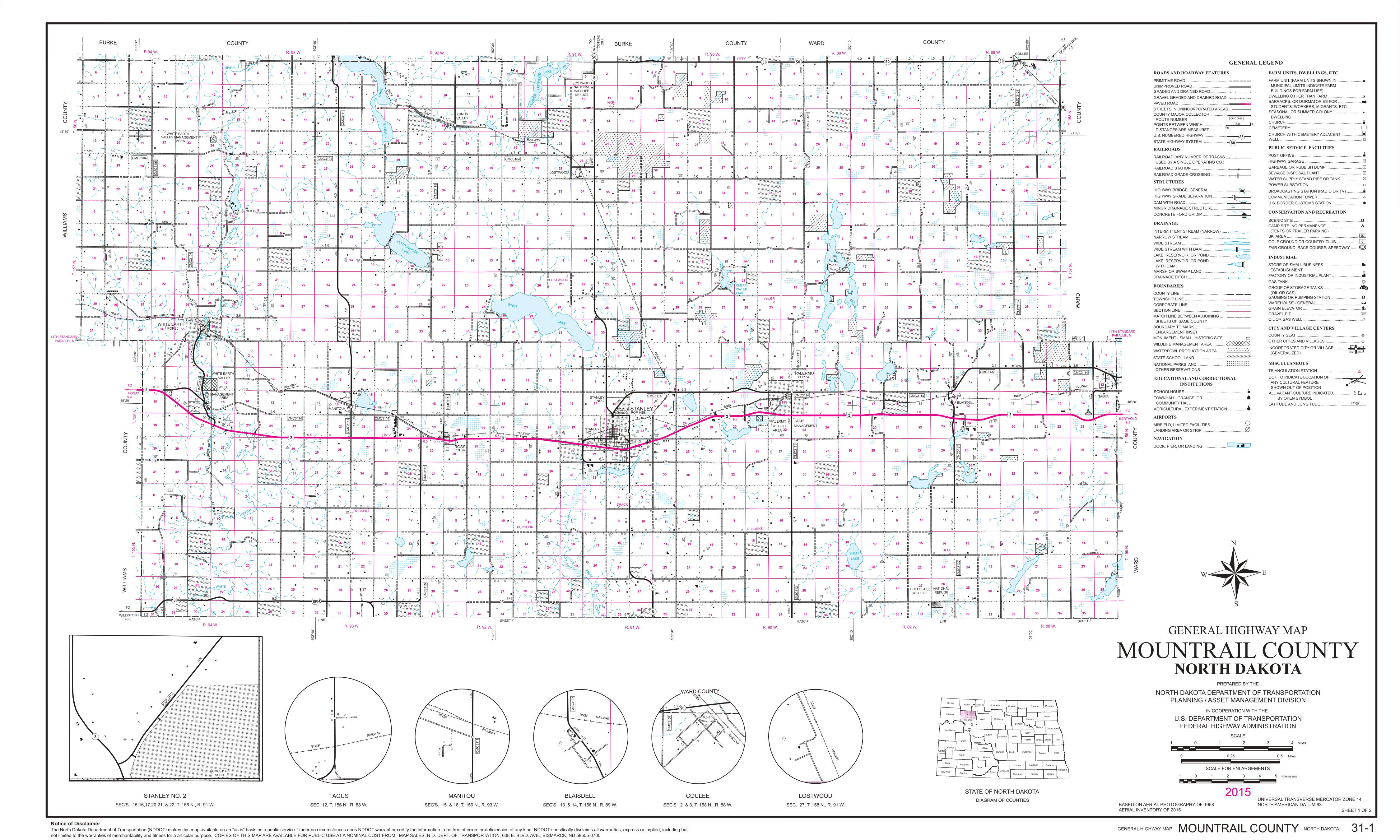
2015 Highway Map - Northern
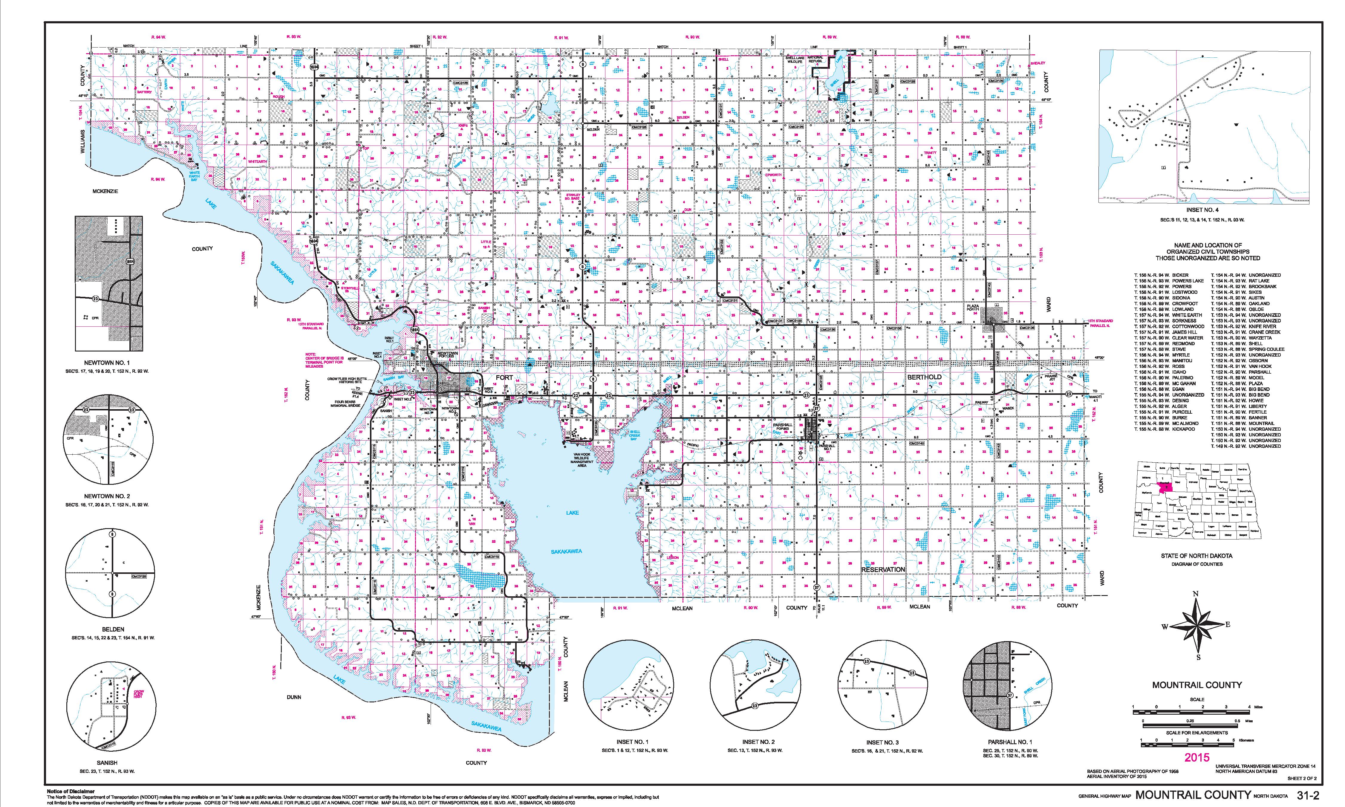
2015 Highway Map - Southern
Alger
Austin
Banner
Bicker
Big Bend
Brookbank
Burke
Clearwater
Cottonwood
Crane Creek
Crowfoot
Debing
Egan
Fertile
Howie
Idaho
James Hill
Kickapoo
Knife River
Liberty
Lostwood
Lowland
Manitou
McAlmond
McGahan
Model
Mountrail
Myrtle
Oakland
Osborn
Osloe
Palermo
Parshall
Plaza
Powers
Powers Lake
Purcell
Rat Lake
Redmond
Ross
Shell
Sidonia
Sikes
Sorkness
Spring Coulee
Stave
Van Hook
Wayzetta
White Earth
Belden
Blaisdell
Coulee
Epworth
Lostwood
Lunds Valley
Manitou
New Town
Palermo
Parshall
Plaza
Prairie Junction
Ross
Sanish
Stanley - county seat
Tagus
VanHook
Wabek
Wassaic
White Earth
Mountrail County NDGenWeb Copyright
Design by
Templates in Time
This page was last updated
01/22/2022