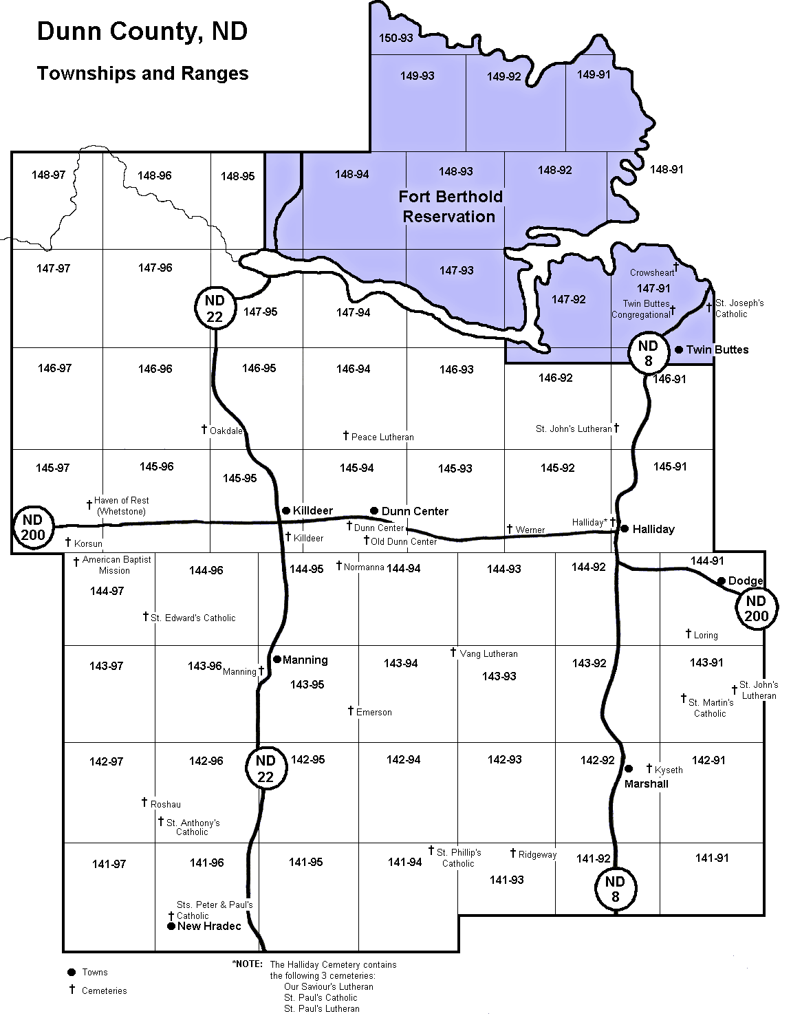
| Townships - Undated | Map of Townships and Ranges in Dunn County. Locations of cemeteries and towns are also indicated. This grid displays the layout of Sections within each township and range. | ||||||||||||||||||||||||||||||||||||
|
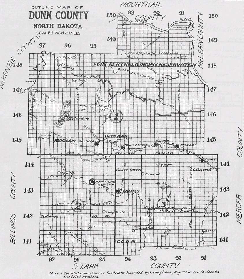
| Dunn County Townships Outline - 1916 | ||
| Dunn County Atlas - 1916 |
Downloaded from Digital Horizons, Life on the Northern Plains Visit them for images of North Dakota history |
|
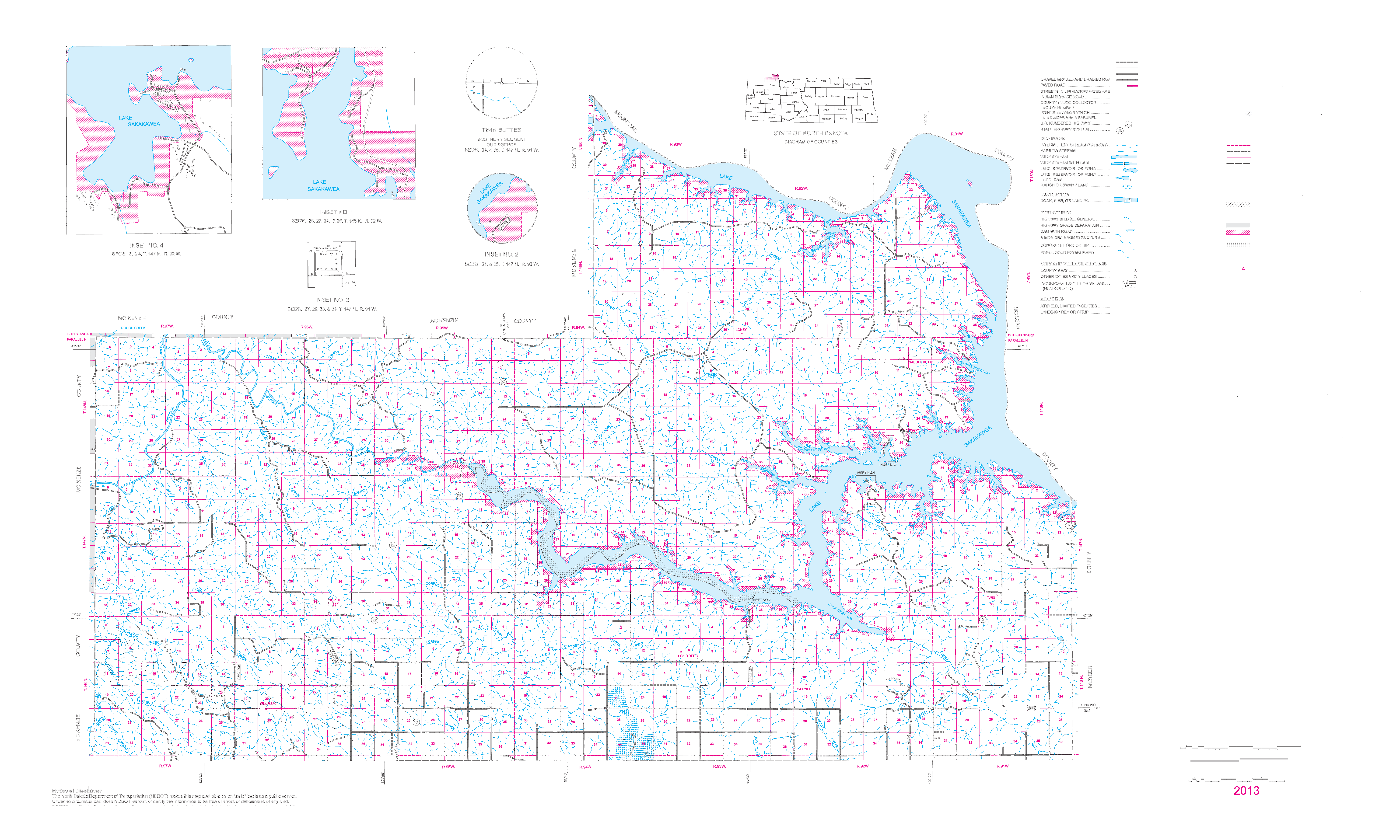
| Dunn County - 2013 | Prepared by the North Dakota Department of Transportation. | |
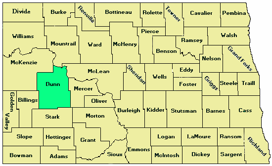
| Dunn County Location Map | Map of North Dakota showing county outlines and the location of Dunn County. Unknown date. | |
|
Maps (Archives) |
With state and county images and information on towns and cities. | |
|
North Dakota County Formation History |
One view shows narrative history and one view shows evolving formation by maps. | |
| North Dakota - 1888/Current | NDGenWeb Map. Compares current counties with 1888 with one picture showing current counties overlayed by 1888 counties. | |
| North Dakota - 1888 | This Territorial map of the northern half of Dakota Territory shows in detail the railroads, counties and villages existing at the time. | |
| North Dakota - 1891 | Detailed. | |
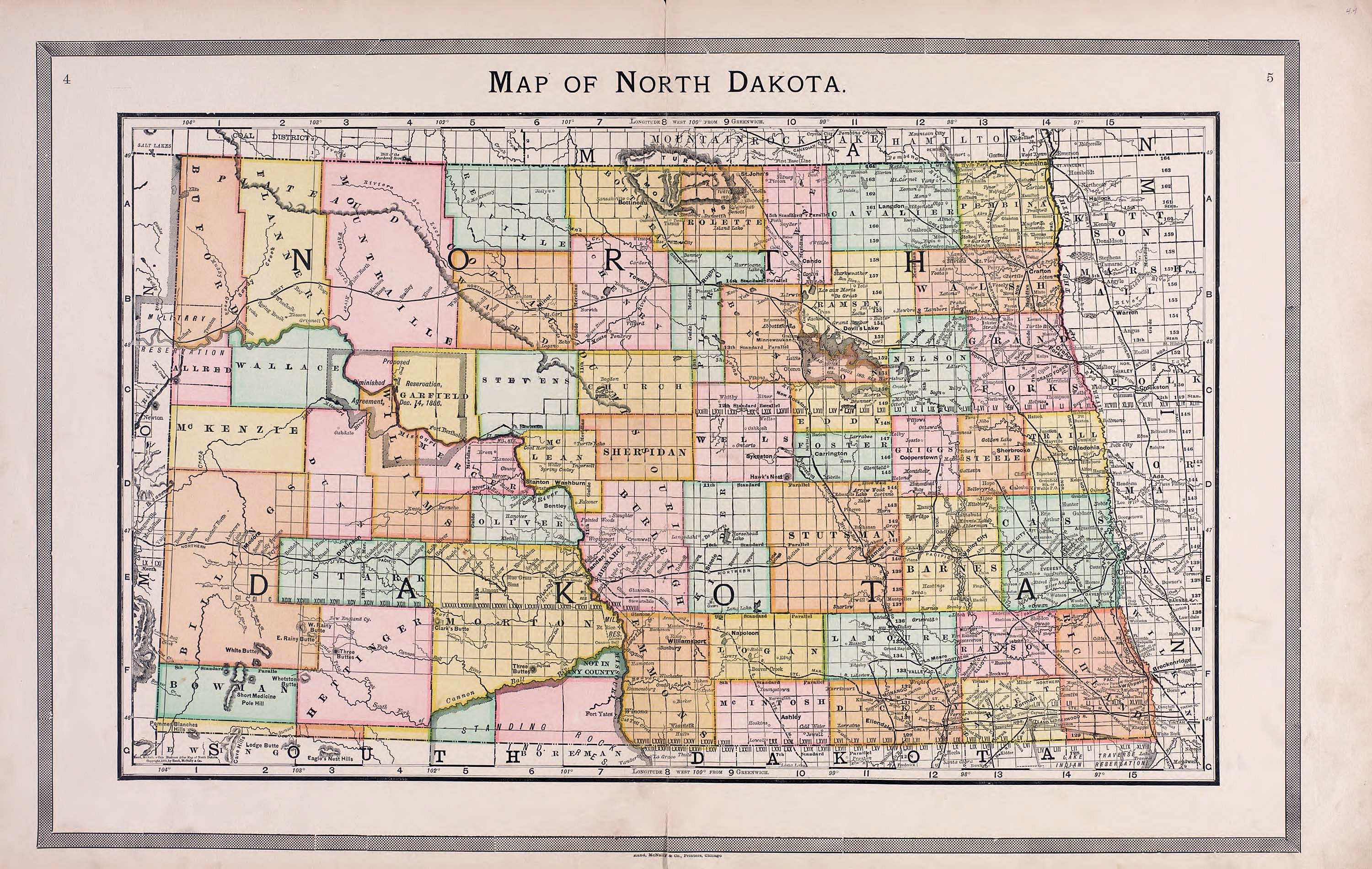
| North Dakota - 1895 | Another of example of beautiful map work detailing towns, villages, cities and railroads of 1895 North Dakota. It is interesting to compare this map with the 1888 map and note the progress made in the intervening 7 years. | |
| North Dakota - 1895/Current | NDGenWeb Map. Compares current counties with 1895 with one picture showing current counties overlayed by 1888 counties. | |
| North Dakota - 1911 | Another of example of beautiful map work detailing towns, villages, cities and railroads of 1911 North Dakota. | |
| North Dakota 1927 | Automobile Road and Road Marker Map | |
| North Dakota - 1972 | Another of example of beautiful map work detailing major cities, rivers, and lakesowns, villages, cities and railroads of 1972 North Dakota. | |
| North Dakota Counties - 1990 | A simple straightforward county outline map from the Library of the University of Texas at Austin. | |
| Current County Maps | The North Dakota Department of Transportation has current county maps for sale. | |
Can't find that place? Give these websites a try: |
||
| USGenWeb Archives Digital Map Library | North Dakota County maps but can link to other states. | |
| USGS | Mapping Information -- Data Base Query Form. | |
| TopoZone | The Web's Topographical Map Site includes topographic maps, orthophotomaps, and aerial photographs for the entire United States. | |
| JewishGen Town Search | Search engine for towns in Central and Eastern Europe. | |